Welcome to the Air-and-Space.com Natural History Museum. Its primary
themes are Geography, Geology, Zoology and Travel. The Air-and-Space.com
Natural History Museum is a one man operation. I take most of the
pictures, write the captions, create the pages, and make all the
arbitrary editorial decisions.
Please note: The Air-and-Space.com Natural History Museum is just my web
site. It is strictly virtual. I have no brickk-and-mortar museum
for people to visit. The Air-and-Space.com Natural History Museum is not
affiliated with any other museum, public or private. It's not
nice to use my pictures on your web site without asking.*
Click on the images below to link to pages of photographs of
natural history related subject matter:
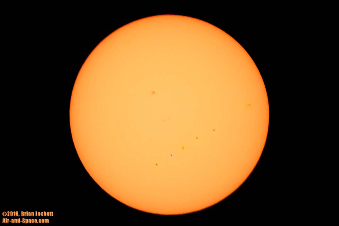
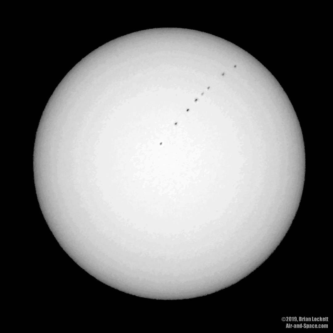
Transit of Mercury
November 11, 2019
Transit of Mercury: The planet Mercury passed directly between the Earth and the Sun this morning. This multiple exposure consists of eight exposures made at 8:43, 8:59, 9:29, 9:43, 9:53, 10:03, 10:20, and 10:41 AM MST. The next transit of Mercury visible fro the United States will occur in the year 2032.
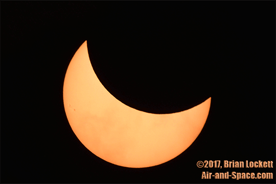
Partial Solar Eclipse
August 21, 2017
On August 21, 2017, the Moon passed between the Earth and the Sun. From Scottsdale, the Moon covered about two thirds of the Sun's disk at the maximum of the eclipse.
Transit of Mercury
May 9, 2016
Transit of Mercury: The planet Mercury passed directly between the Earth and the Sun this morning. This image is composed of six exposures made at 6:29, 7:07, 7:37, 8:24, 9:12, and 10:51.
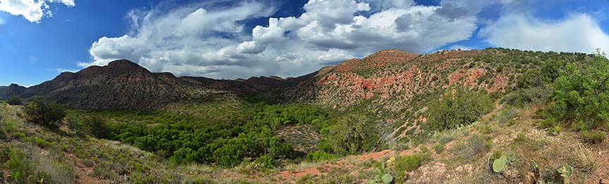
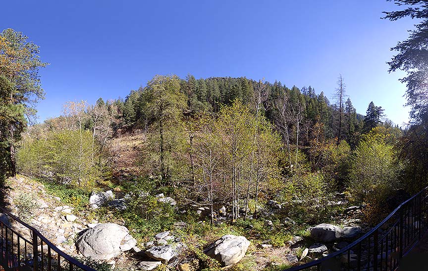
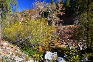
Sycamore Canyon
April 16, 2015
On April 16, 2015, I went on a hike in Sycamore Canyon, a few miles north of Cottonwood. The trail runs along Sycamore Creek. A variety of wildflowers are in bloom.
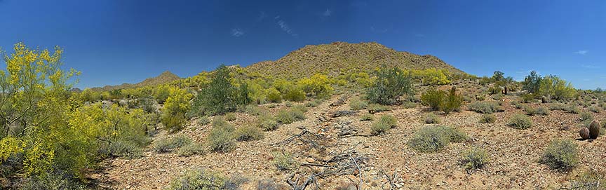
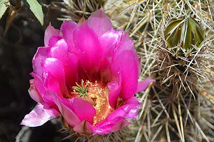
Wildflowers at San Tan Mountain Regional Park
April 9, 2015
On April 9, 2015, I went on a couple of short hikes at San Tan Mountain Regional Park to photograph spring wildflowers. Palo Verde Trees are covered in yellow flowers. Hedgehog, Cholla, and Prickly Pear Cacti are blooming.
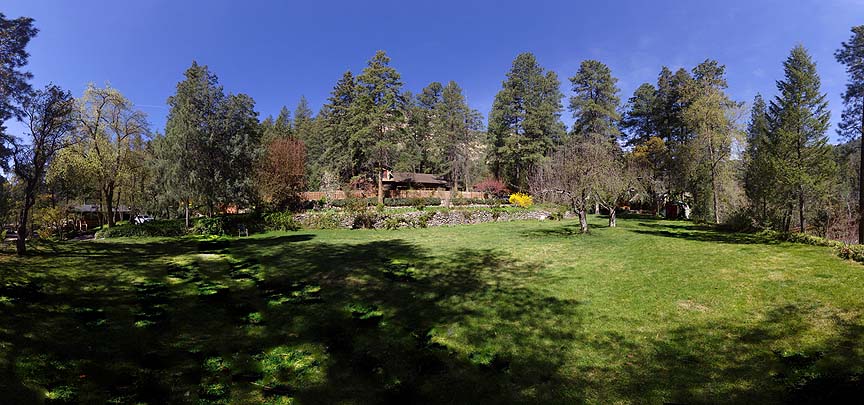
Forest Houses
Forest Houses Resort is a compound of cabins situated on 20 wooded acres in upper Oak Creek Canyon. Each cabin is different. My family has been renting cabins at Forest Houses for many years.
Wildflowers at McDowell Mountain Regional Park
March 20, 2015
On March 20, 2015, I returned to McDowell Mountain Regional Park to photograph spring wildflowers. Creosote bushes are covered in yellow flowers. Penstemon are blooming along the numerous washes. Many Hedgehog cacti have started blooming. Buckorn Cholla sport flower buds on all their arms and should bloom spectacularly in the near future.
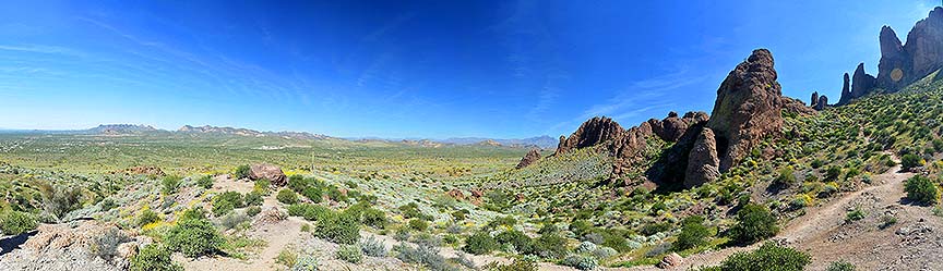
Lost Dutchman State Park
March 15, 2015
On March 15, 2015, I went for a short hike in Lost Dutchman State Park. A popular hiking trail leads up to the base of the cliffs of the Superstition Mountains.
McDowell Mountain Regional Park
February 12, 2015
On February 12, 2015, I went for a short hike in McDowell Mountain Regional Park.
Cave Creek Regional Park
January 26, 2015
On January 26, 2015, I went for a short hike in Cave Creek Regional Park.
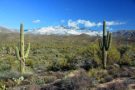
Snow on Four Peaks
January 2, 2015
On New Year's Eve, a winter storm dropped snow at uncommonly low elevations. On January 2, I photographed the snow on Four Peaks and other mountains in Usery Mountain Regional Park.
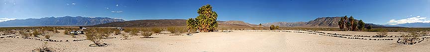
Saline Valley
November 18 - 21, 2014
I arrived at Palm Spring Camp in the Saline Valley with friends on Monday, November 17 at sunset. We set up camp and stayed until Friday, November 21.
Time lapse movies taken in the Saline Valley in Death Valley National Park from November 18 to November 21, 2014. The speed of the action has been increased by a factor of 240. Fifteen seconds of video shows one hour of real time
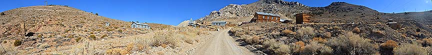
Cerro Gordo
November 17, 2014
On Monday, November 17, I drove up to the ghost town of Cerro Gordo at the crest of the Inyo Mountains with friends. We drove to the town of Keeler on the edge of Owens Dry Lake, and turned up the dirt road leading to Cerro Gordo. When we arrived at the ghost town, Robert, the local caretaker, drove out on his quad and greeted us. He treated us to a tour of the town, opening up all the buildings and the museum, which houses a collection of artifacts from the heyday of the mining industry.
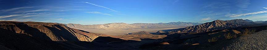
Panamint Valley
November 16, 2014
On Sunday, November 16, I toured the Panamint Valley with friends. We stopped in Trona for lunch at Esparza Family Restaurant. We visited the ghost town of Ballarat and continued up the Indian Ranch Road on the east side of the Panamint Valley. We surveyed the valley from the Father Crowley Viewpoint.
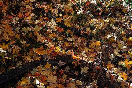
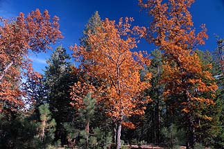
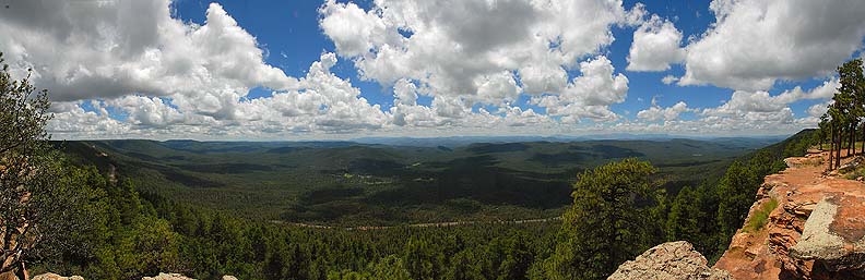
Fall Colors on the Mogollon Rim
October 23, 2014
On October 23, 2014, I toured the Mogollon Rim near Payson, Arizona to photograph the fall colors. I followed the Rim Road
and other forest roads from Woods Canyon Lake to Highway 87 north of Strawberry. The weather was sunny and warm.
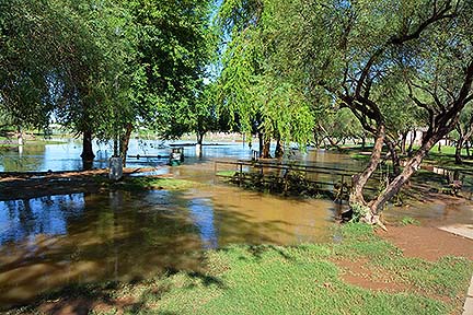
Scottsdale Storm Damage
September 28, 2014
A major storm brought heavy rainfall and gale force winds to the Valley of the Sun on Saturday, September 27. Many trees have toppled and streets and parks are flooded.
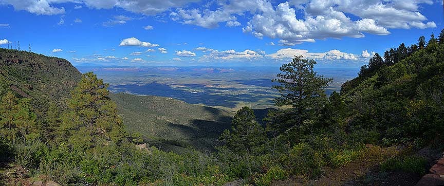
Mingus Mountain
September 25, 2014
On September 25, I drvoe through the town of Cherry to Mingus Mountain, overlooking the Verde Valley. The town of Cottonwood was directly below and the red rocks cliffs of Sedona could be seen an the far side of the valley as thunderheads built up in the distance.
Flagstaff Weather Time Lapse
July 23 - 24, 2014
Time lapse movie of weather near Flagstaff, Arizona on July 23 and 24, 2014. The speed of the action has been increased by a factor of 120.
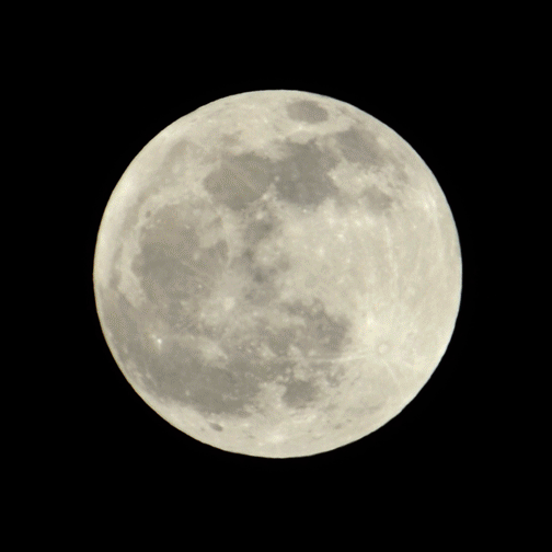
Total Lunar Eclipse, April 14 - 15, 2014
The full Moon slipped through the Earth's shadow during the night of April 14 - 15, 2014.
Oak Creek Canyon
March 31, 2014
Forest Houses is a compound of cabins ini Oak Creek Canyon. Each cabin is different. My sister has been renting cabins at Forest Houses for many years. I joined her for a few days at Chalet, on the bank of Oak Creek.
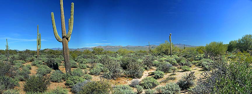
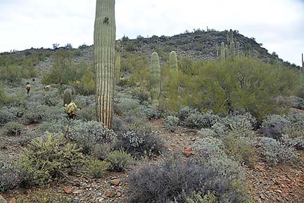
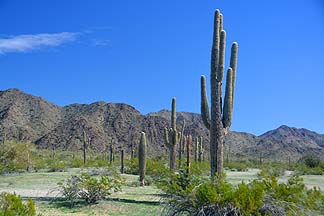
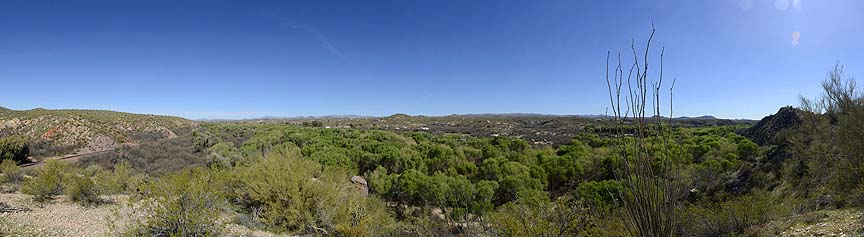
Sonoran Desert National Monument
January 28, 2014
The Sonoran Desert National Monument encompasses 487,000 acres southwest of Phoenix. Much of the monument is wilderness with no motorized access. Route 8001 skirts the north edge of the North Maricopa Mountains Wilderness. It can be accessed from Highway 85 at Woods Road, about 21 miles south of I-17. There is no sign for the monument at the highway. It follows a narrow valley between rugged mountains of the North Maricopa Range. Saguaros and Creosote are the predominant plants. Mesquite and Palo Verde Trees grow along numerous dry washes.
Oak Creek Canyon
November 11, 2013
Forest Houses is a compound of cabins ini Oak Creek Canyon. Each cabin is different. My sister has been renting cabins at Forest Houses for many years. I joined her for a few days at Cloud House, on the bank of Oak Creek.
Flagstaff Weather Time Lapse
September 6 - 11, 2013
Time lapse movie of weather near Flagstaff, Arizona from September 6 to 11, 2013. The speed of the action has been increased by a factor of 120.
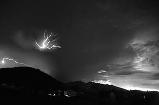
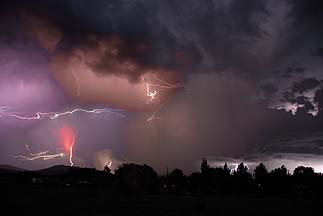
Pioneer Valley Lightning
July 20, 2013
Thunderstorms moved through the Flagstaff area on Saturday, July 20. I set up a camera to shoot a time lapse movie of the lightning.
Flagstaff Monsoon Weather Time Lapse
July 15 - 20, 2013
Time lapse movie of monsoon weather near Flagstaff, Arizona from July 15 to 17, 2013. The speed of the action has been increased by a factor of 120.
Time lapse movie of monsoon weather near Flagstaff, Arizona from July 18 to 20, 2013. The speed of the action has been increased by a factor of 120. The speed of the action of the lightning storm at the end of the video has been increased by a factor of 20.
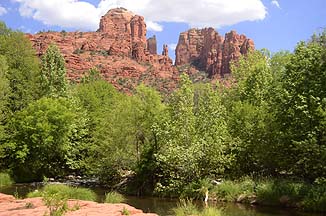
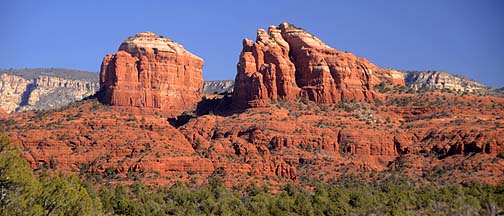
Red Rock Crossing
May 30, 2013
Red Rock Crossing is located on Oak Creek near Sedona. It features good views of Cathedral Rock, which is a popular subject for photographers and painters. It is also popular with new agers who meditate at the Cathedral Rock Vortex and build numerous rock cairns.
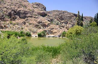
Hassayampa River Preserve
March 14, 2013
The Nature Conservancy maintains a desert river habitat at the Hassayampa River Preserve near Wickenberg, Arizona.
Comet PanSTARRS
March 13, 2013
Comet PanSTARRS can be seen shortly after sunset for the next few days. It appears just a few minutes before it sets. Use binoculars to see it.
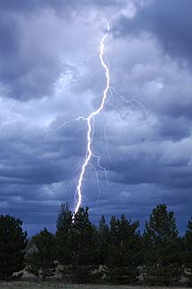
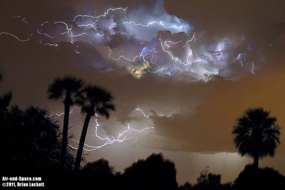
Lightning
Updated August 2012
The Lightning Display has been updated with photos and time lapse movies of the 2012 monsoon.
Monsoon Weather Over the Valley of the Sun
July 28 - 29, 2012
Time lapse movies of rainfall and turbulence on the underside of a cumulonimbus cloud over Scottsdale on July 28 and the approach of a cumulonimbus cell toward Phoenix on July 29, 2012. The speed of the action has been increased by a factor of 150
Monsoon Weather Over Pioneer Valley
July 2012
I spent several days in Pioneer Valley, northeast of Flagstaff, Arizona photographing the summer thunderstorms associated with the monsoon weather. Warm, moist air from the Gulf of Mexico moved into the area on Thursday, July 19.
Monsoon Weather Over Flagstaff Time Lapse Movie, July 19 - 24, 2012
I spent several days in Pioneer Valley, northeast of Flagstaff, Arizona photographing the summer thunderstorms associated with the monsoon weather. Warm, moist air from the Gulf of Mexico moved into the area on Thursday, July 19. I shot exposures at five second intervals to assemble a time lapse movie. At night the exposures were four seconds long to capture the flashes of lightning.
Pioneer Valley Lightning Time Lapse Movie, July 21 - 24, 2012
I reprocessed the lightning sequences from my Monsoon Weather Over Flagstaff video to improve the visibility of the lightning.
Transit of Venus
June 5, 2012
On June 5, 2012, the planet Venus passed between the Earth and the Sun. This will not happen again until the year 2117.
Annular Solar Eclipse
May 20, 2012
On May 20, 2102, the Moon passed between the Earth and the Sun. The Moon was near Apogee, the high point in its orbit, so it did not cover the entire face of the Sun, resulting in an annular eclipse.
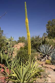
Boyce Thompson Arboretum
April 23, 2012
I recently toured the Boyce Thompson Arboretum near Superior, Arizona on sunny spring day. Many types of Agave were sending up flower spikes. Flower buds are appearing on the Saguaros, but only a few have bloomed.
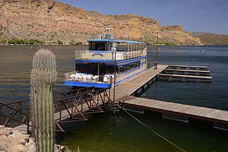
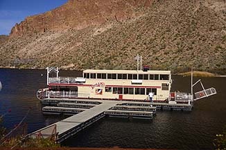
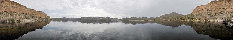
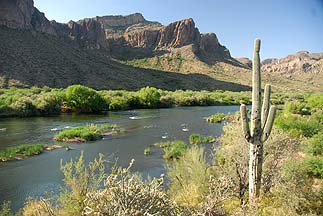
Saguaro Lake Cruise, April 19, 2012
I recently went for a 90 minute cruise on Saguaro Lake aboard the Desert Belle. Saguaro Lake is located east of Phoenix on the Salt River, downriver of Canyon Lake and Apache Lake. The landscape is dominated by Four Peaks and the Goldfield Mountains. It is reached by way of the Bush Highway.
Red Rock State Park, February 9, 2012
Oak Creek meanders through Red Rock State Park near Sedona. The creek is lined with Sycamore and Cottonwood Trees. Several hiking trails provide access to the hills that surround the park.
Canyon Lake Cruise, December 31, 2011
I recently went for a 90 minute cruise on Canyon Lake aboard the stern-wheeler Dolly. Canyon Lake is located east of Phoenix on the Salt River, between Saguaro Lake and Apache Lake. The landscape is dominated by eroded volcanic tuff from a giagantic caldera eruption that occurred about twenty-nine million years ago.
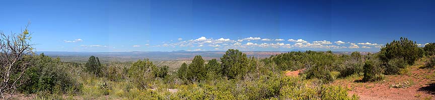
Touring Arizona, Summer 2011
I have been touring back roads around Flagstaff and the Mogollon Rim seeking landscapes to photograph.
Arizona Gigapan Update
September 25, 2011
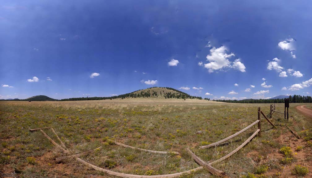
My latest Arizona Gigapans feature Sunset Crater, the San Francicsco Peaks, White Horse Hils, the Verde Valley, Eldon Hills, and Willow Spring Lake.
A low pressure zone hovering over southern Utah directed unstable air into northern Arizona from the west, opposite the usual monsoon flow. Cumulus clouds form over the San Francisco peaks, building to the stratosphere, becoming cumulonimbus clouds that drop heavy rain, and spout downbursts. as they drift across the landscape. The speed of the action in this time lapse movie has been increased by a factor of 120.
Cumulonimbus clouds drift across the east valley bringing rain, lightning, and thunder. The speed of the action in this time lapse movie has been increased by a factor of 120 during the day and 150 after sunsset.
This image was assembled from 22 exposures taken between 7:42 PM and 7:54 PM.
Warm, moist air from the Gulf of Mexico brings turbulent air, cumulus clouds and localized showers to the Flagstaff area. Towering Cumulonimbus clouds rise seven miles to the bottom of the Stratosphere and then spread across the sky. The San Francisco Peaks can be seen to produce their own orographic cloudes. This movie was shot from August 24 to August 27. The speed of the action in this time lapse movie has been increased by a factor of 120.
This movie was shot from August 28 to August 31.
Arizona Gigapan Update
September 3, 2011
My latest Arizona Gigapans were taken in the Coconino and Kaibab National Forests near San Francicsco Peaks.
California Panoramas slideshow video
Here's a pan and scan tour of panoramas that I made of California landmarks.
Time lapse movie of another Haboob blowing through Phoenix, Arizona on August 18, 2011. This time lapse movie speeds up the action by a factor of 120.
Arizona Panoramas slideshow video
View my panoramic Arizona landscape photography. These panoramas are stitched together from multiple images to produce very wide angle, high resolution images. Many of these panoramas were taken with the assistance of a Gigapan robotic camera mount. Some of them were assembled from over 500 pictures and could be printed over four feet tall. Part 1 shows panoramas taken from December 2008 to August 2010.
View my panoramic Arizona landscape photography. Part 2 shows panoramas taken from August 2010 to July 2011.
Time lapse movie of monsoon weather over Phoenix, Arizona on July 31, 2011. A large thundercell approaches Phoenix from the southeast. A Haboob blows across the lower frame from left to right. After sunset, lightning flashes illuminate the clouds. Air traffic at Sky Harbor Airport reroutes to avoid the dust and storm clouds. This time lapse movie speeds up the action by a factor of 120.
Arizona Gigapan Update
July 29, 2011
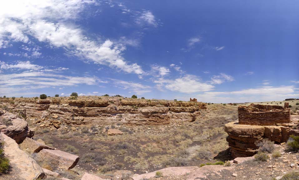
My latest Arizona Gigapans were taken of ancient stone dwellings at Wupatki National Monument.
Warm, moist air from the Gulf of Mexico brings turbulent air, cumulus clouds and localized showers to the Flagstaff area. The San Francisco Peaks can be seen to produce their own orographic cloudes. The speed of the action in this time lapse movie has been increased by a factor of 120.
Time lapse movie of monsoon weather over Phoenix, Arizona on July 18, 2011. The turbulent skies produced a haboob that swept across Phoenix and fumigated the neighborhood with dust. This time lapse movie speeds up the action by a factor of 120.
Here's a short time lapse movie of the Haboob that blew across the valley on July 5, 2011.
Little Painted Desert and Homol'ovi State Park
June 13, 2011
On June 13, 2011, I visited Winslow, Arizona. I continued out Highway 87 and visited Little Painted Desert County Park and Homol'ovi State Park ancestral Hopi villages.
Boyce Thompson Arboretum
May 20, 2011
I recently toured the Boyce Thompson Arboretum near Superior, Arizona on sunny spring day. Many types of Agave were sending up flower spikes that will bloom in the near future. Flower buds are appearing on the Saguaros, but only a few have bloomed.
Salt River
February 18, 2011
The Salt River flows down from Roosevelt Lake through a series of reservoirs to and through the city of Phoenix.
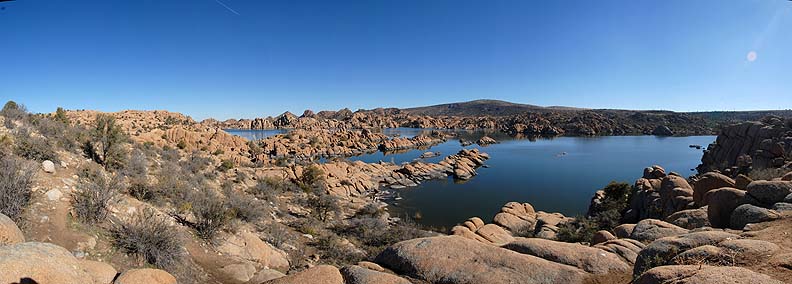
Watson Lake
January 24, 2011
Watson Lake is a man-made reservoir nestled among granitic bouolders near Prescott, Arizona. It is a popular recreational destination, offering fishing, bird-watching, boulder climbing, hiking, and boating. Kayaks and canoes can be rented. I visited Watson Lake on January 24.
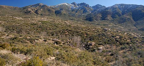
Four Peaks Road Trip
January 13, 2011
In late December, a winter storm dropped a load of snow on Arizona. Snow still remained on the north slopes of Four Peaks two weeks later. On January 13, I drove up the Soldier Camp Trail through Brushy Basin up to the Pigeon Spring Road on the top of the ridge and then descended down the el Oso Road into the Tonto Basin above Roosevelt Lake.
Fall Colors on the Mogollon Rim
October 21 and November 4, 2010
On October 21, I toured the Mogollon Rim near Payson, Arizona to photograph the fall colors. I followed the Rim Road and other forest roads from Woods Canyon Lake to Highway 87 north of Strawberry. The weather was overcast and it rained intermittently. I returned to the Coconino Forest above the Mogollon Rim on Thursday, November 4 to photograph more fall color.
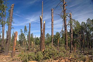
Arizona Storm Damage
October 21 and November 4, 2010
As I was exploring forest roads above the Mogollon Rim on Thursday, October 21, I found an area where many of the trees had been broken off or knocked over. I returned to the Coconino Forest above the Mogollon Rim on Thursday, November 4 to photograph more of the tornado damage.
If a tornado rips down hundreds of trees in the forest, but there is nobody there to hear it, does it make a sound?
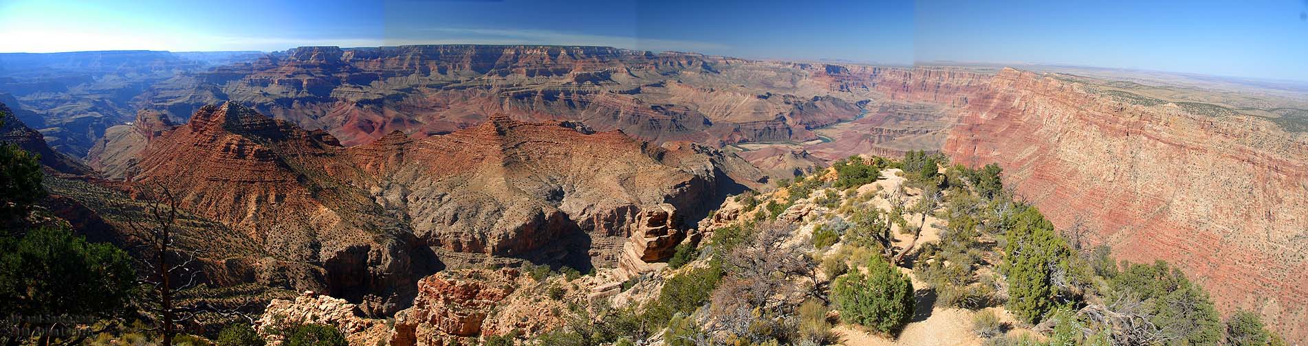
Grand Canyon, Vermilion Cliffs, and Marble Canyon
September 24 - 25, 2010
I visited the south rim of the Grand Canyon on September 24. The next day I visited the north rim of the Grand Canyon. On my way back to Flagstaff, I drove along the Vermilion Cliffs and crossed Marble Canyon on the Navajo Bridge.
Tonto Natural Bridge
September 16, 2010
Tonto Natural Bridge is the largest travertine bridge in the United States. It is located north of Payson off Highway 87.
Meteor Crater, Walnut Canyon, and Grand Falls
August 26 - 31, 2010
I recently visited Flagstaff and did some sight-seeing. I shot panoramas at Meteor Crater, Walnut Canyon National Monument and Grand Falls on the Little Colorado River. I shot a time lapse movie showing two days of monsoon weather.
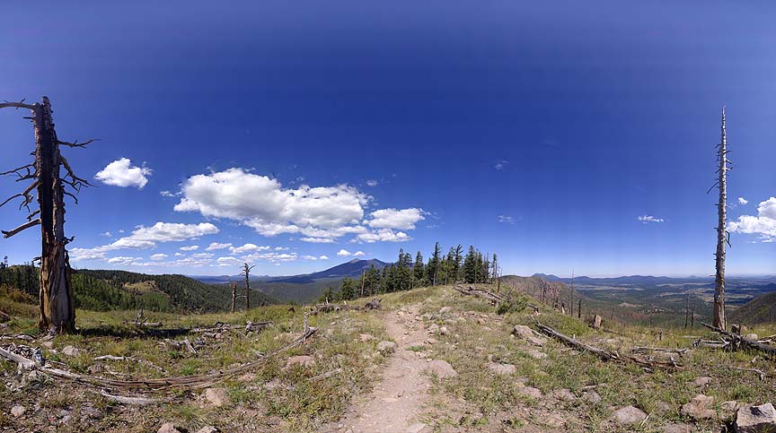
Mogollon Rim, Arizona
August 8, 2010
On Sunday August 8, I took a day trip up to Payson and the Mogollon Rim, where I visited
Willow Springs Lake. I shot panoramas and a time lapse movie of the lake.
Coconino County, Arizona, June 2010
In late June I visited Flagstaff. The Schultz Fire had started several days earlier and burned much of the east side of San Francisco Peaks. I explored the forest roads leading south to overlooks of the West Fork of Oak Creek Canyon and the Red Rock Secret Wilderness.
Salt River
April 29, 2010
The Salt River flows down from Roosevelt Lake through a series of reservoirs to and through the city of Phoenix. It is running very high this spring.
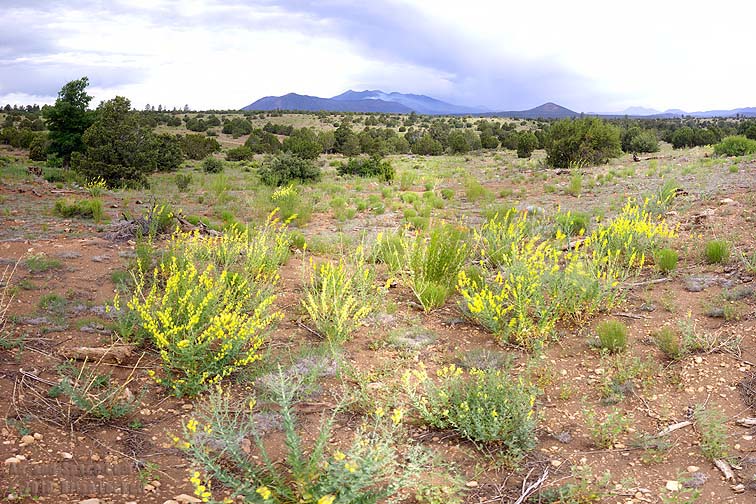
California Desert Wildflowers
April 11, 2010
Ocotillo, Creosote, and Brittlebush are in bloom near Desert Center, California
You can buy framed prints and greeting cards of this photo.
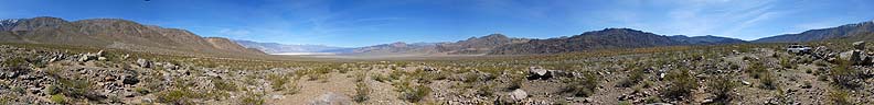
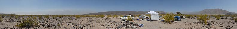
Springtime in the Saline Valley
April 6 - 10, 2010
I spent five days camping in the Saline Valley in April 2010. Lows were in the 40s, the highs were in the eighties. The sky was mostly cloudless. The wind was fairly calm until the last two nights.
Page 1: Driving into the valley
You can buy framed prints and greeting cards of this photo.
Page 2: Campout
Four Peaks
January 25, 2010
After a recent winter storm, I drove east out of Scottsdale to Four Peaks in the Tonto National Forest.
You can buy framed prints and greeting cards of this photograph.
Boyce Thompson Arboretum
January 17, 2010
I recently toured the Boyce Thompson Arboretum near Superior, Arizona on an overcast day. A Coati Mundi was munching berries in a tree along the trail.
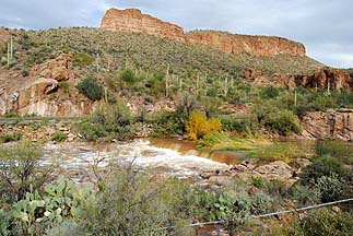
Apache Trail, December 26, 2008
After a week of winter storms, I drove out the Apache Trail to Tortilla Flat.
 Transit of Mercury: The planet Mercury passed directly between the Earth and the Sun this morning. This multiple exposure consists of eight exposures made at 8:43, 8:59, 9:29, 9:43, 9:53, 10:03, 10:20, and 10:41 AM MST. The next transit of Mercury visible fro the United States will occur in the year 2032.