
Zaca Fire |
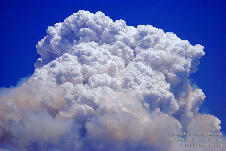
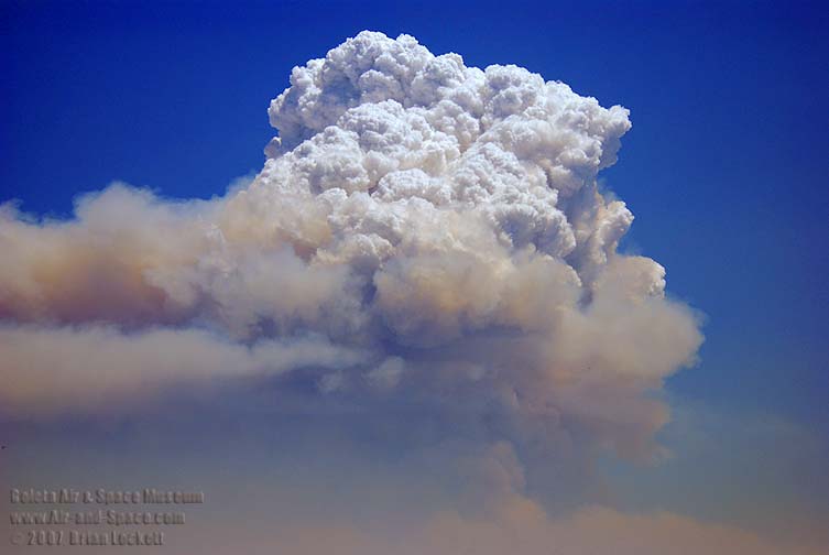
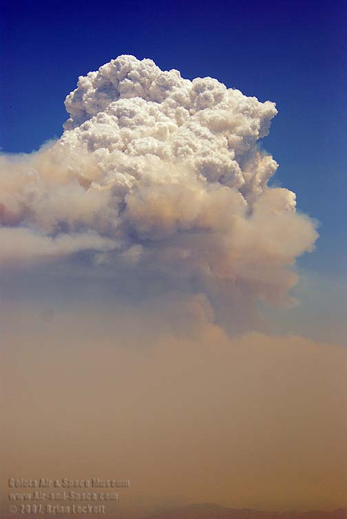
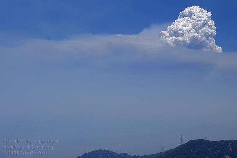
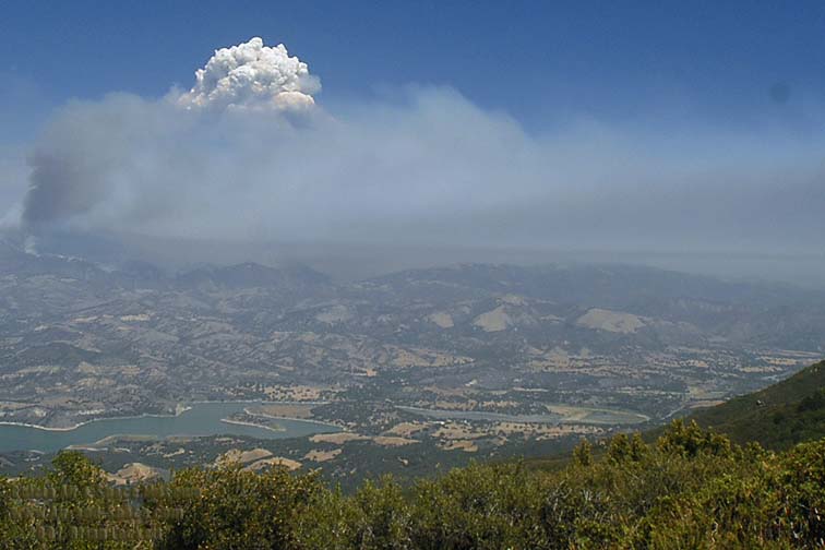
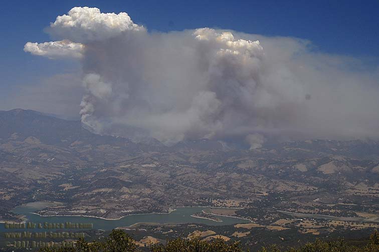
On Tuesday, August 14, a smoky haze filled the Santa Ynez Valley. Around noon, the Zaca Fire started sending up columns of dark smoke, capped with pyrocumulus clouds. The fire gained energy and produced very large plumes of dark smoke that punched up to higher altitude. As the source of energy was momentarily depleted, the clouds fell back and evaporated, leaving ash suspended high above the fire. The upper level smoke drifted away in a different direction than the smoke hugging the ground. The plumes grew more energetic and reached progressively higher altitude, peaking about six miles above the ground. Smoke from the fire fumigated the Santa Ynez Valley and finally obscured the view of the towering pyrocumulus cloud.
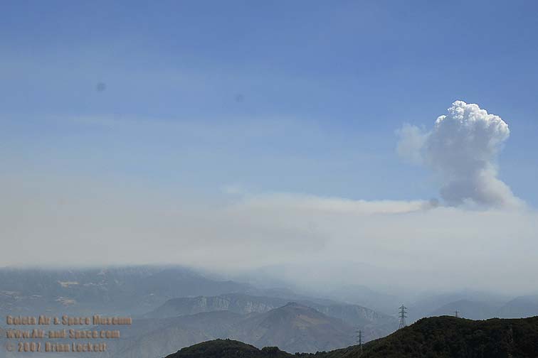 11:19 AM
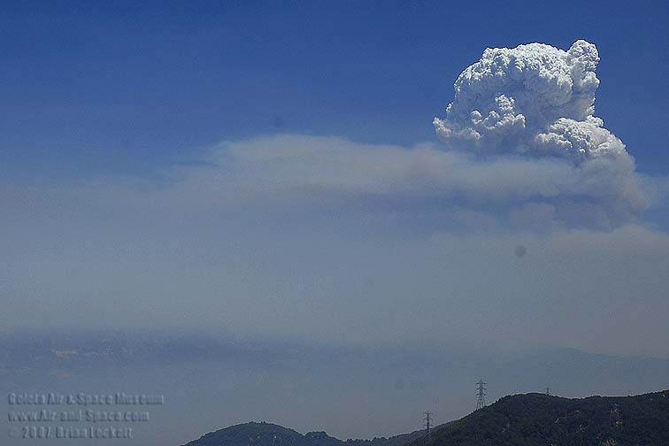 12:37PM
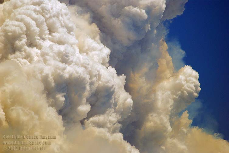
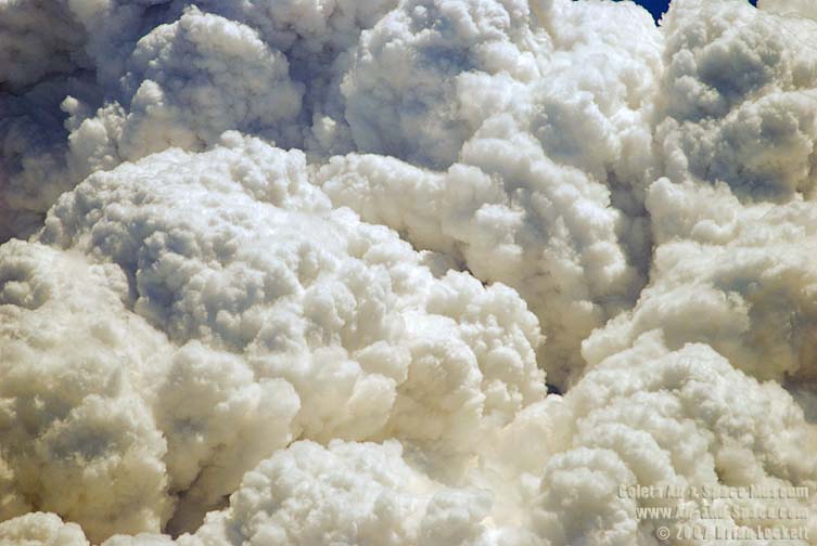
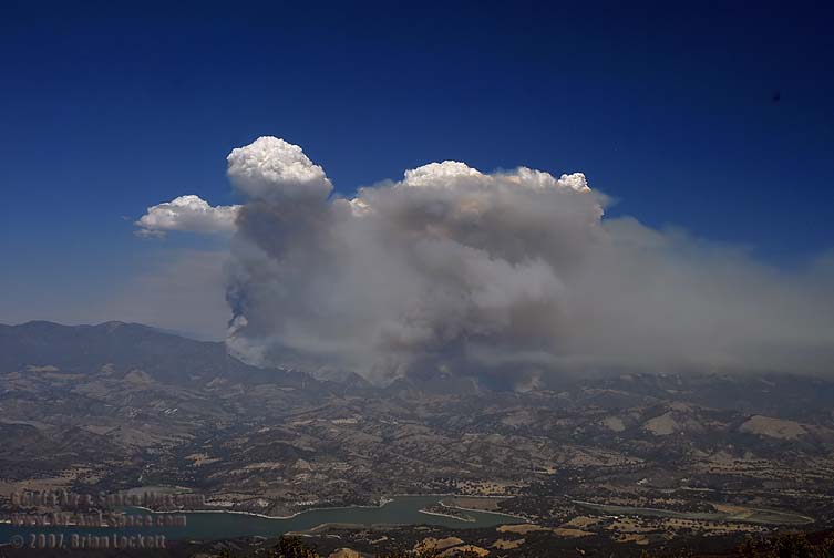
 This close-up of the giant pyrocumulus cloud shows puffs of gray smoke in the nooks of the white cloud. 12:43 PM
 12:43 PM
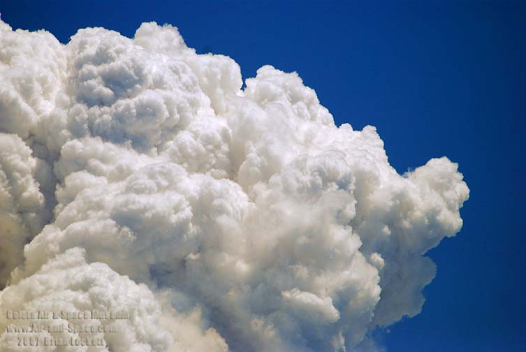 12:43 PM
 12:44 PM
 12:44 PM
 12:44 PM
 12:44 PM
 1:17 PM
I shot this time lapse movie from 11:54 AM to 1:34 PM on Tuesday, August 14, 2007. The action is speeded up 125x.
This video has been cropped for a better view of the pyrocumulus clouds.
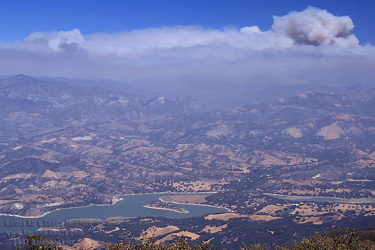
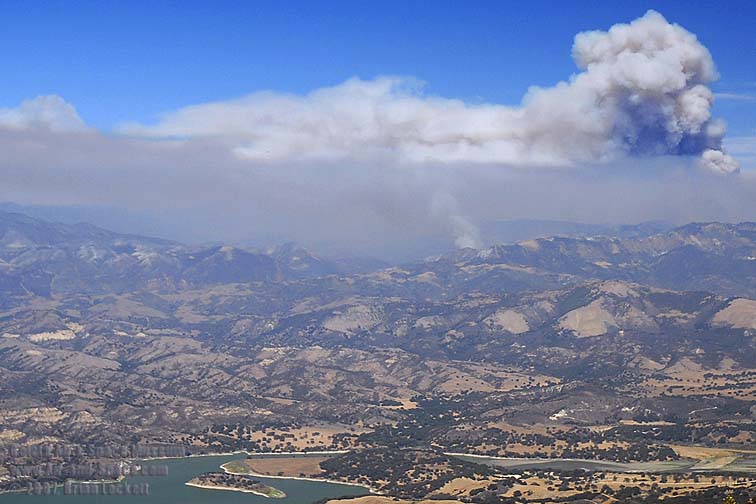
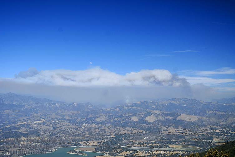
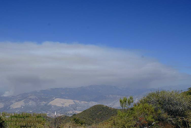
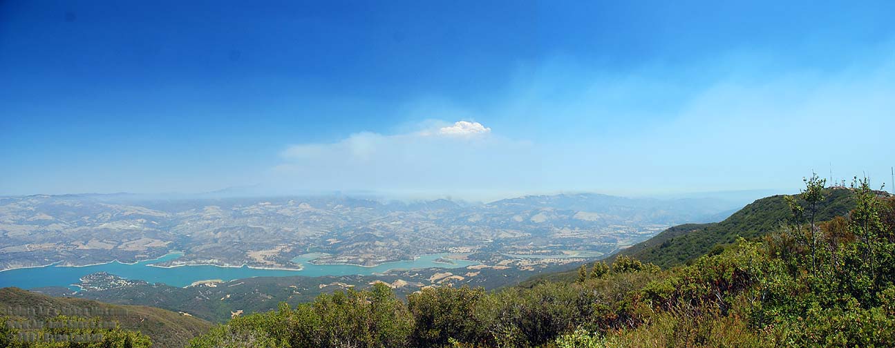
On Sunday, August 12, the wind carried the smoke from the Zaca Fire away to the northwest. A layer of smoke near the ground obscured the fire zone. Occasional pulses of energy from pockets of fuel produced puffs of smoke that rose above the haze and then fell back as the plume moved away from the source of heat.
 2:10 PM
 3:01 PM
 3:35 PM
I shot this time lapse movie from 2:22 PM to 3:35 PM on Sunday, August 12, 2007. The action is speeded up 125x.
This video has been cropped for a better view of the rising smoke.
On Thursday, August 9, the the wind was relatively calm. The Zaca Fire burned in the area to the east of Little Pine Mountain. The pall of smoke over the Dick Smith Wilderness grew deeper over the day.
 2:22 PM
 3:45 PM
I shot this time lapse movie from 2:22 PM to 3:45 PM on Thursday, August 9, 2007. The action is speeded up 125x.
On Saturday, August 4, the wind was blowing from northwest to southeast. The Zaca Fire progressed toward Little Pine Mountain and sent up several plumes as it reached pockets of fuel. The rising columns of hot air cooled until pyrocumulus clouds formed above the fire. The clouds billowed and subsided as the amount of energy from the fire varied.
 12:59 PM
 2:02 PM
 2:47PM
 2:52 PM
 4:01 PM
I shot this time lapse movie of the Zaca Fire near Broadcast Peak in the Santa Ynez Mountains from 2:07 PM to 4:01 PM on Saturday, August 4, 2007. It illustrates pyrocumulus clouds forming above the rising hot air from the fire. The action is speeded up 125x.
This video has been cropped for a better view of the pyrocumulus clouds.
You can buy a 2019 Calendar featuring my photographs of pyrocumulus clouds over the Zaca Fire in Santa Barbara County in August 2007.
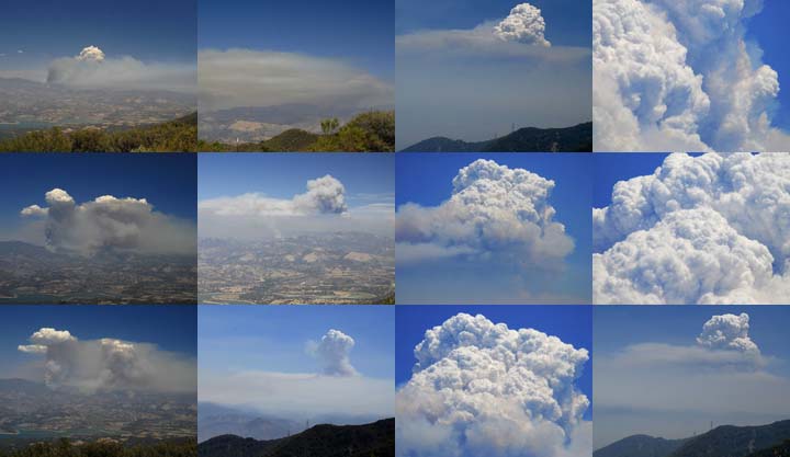
A dozen photos of pyrocumulus clouds over the Zaca Fire in Santa Barbara County in August 2007.
 Put a copy of the Fire Clouds: 2019 Calendar in your Lulu.com shopping cart for $14.95.
Send a message to Brian.