
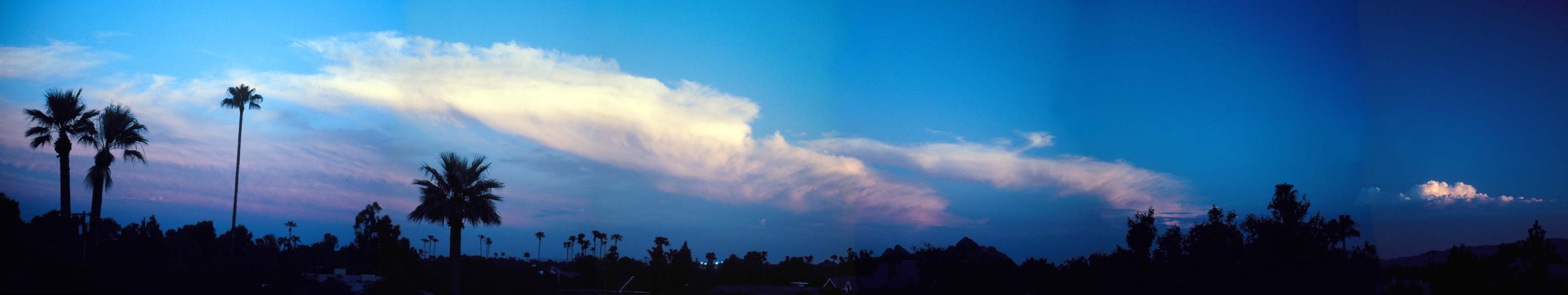
Panoramas and Little Planets |
The many panoramic photographs that appear in the displays of the museum have been assembled into a single display. Some of the 360-degree panoramas have been warped to make intriguing little planets.
Update March 4, 2008: I used some new methods to build panoramas from old slides that required a lot of perspective correction. I also straightened out some of the more recent panoramas.

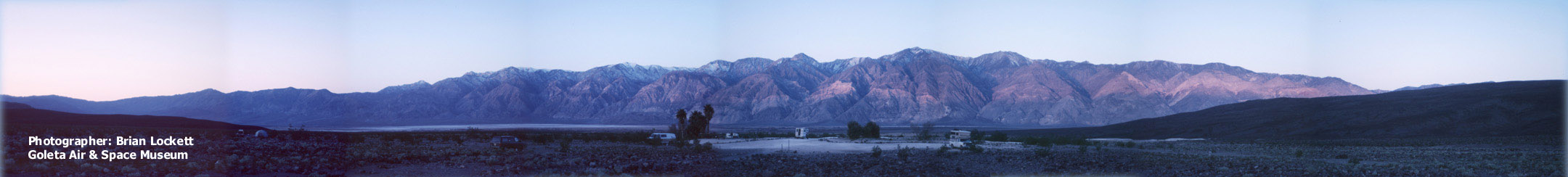
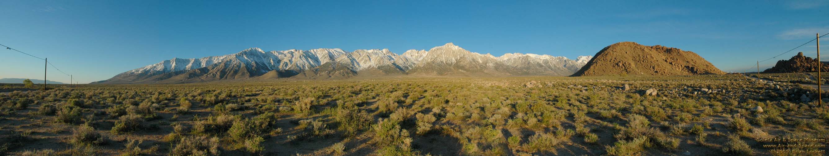
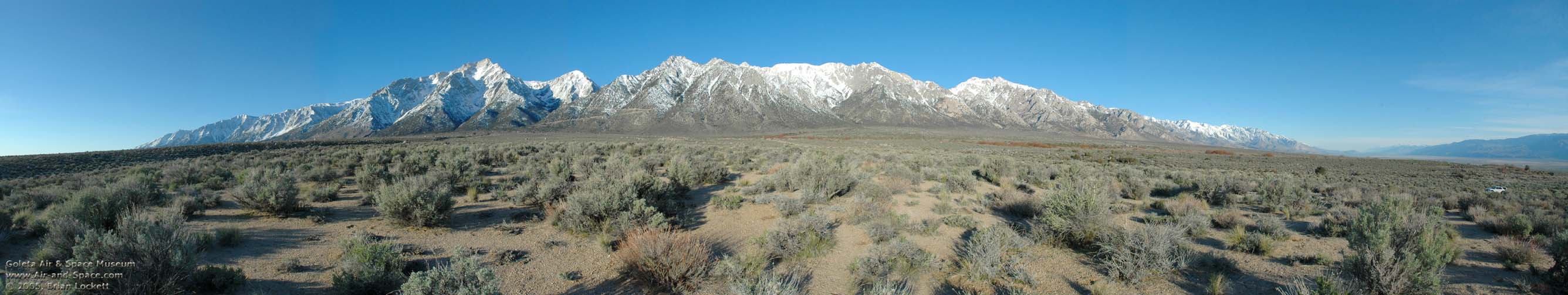
 The Sierra Nevada and Owens Valley from Owens Lake to Bishop.
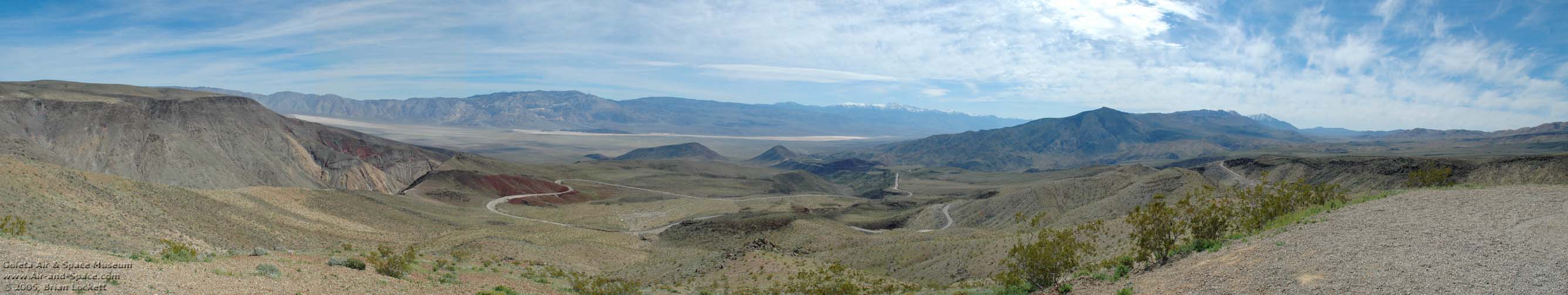
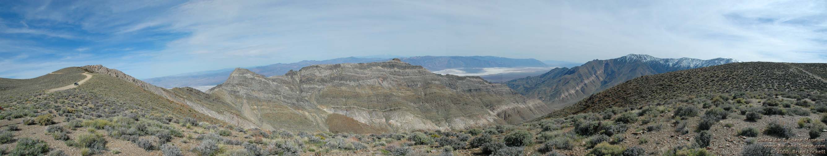
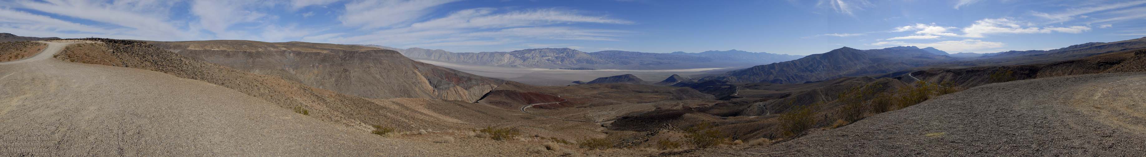
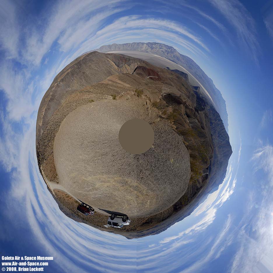
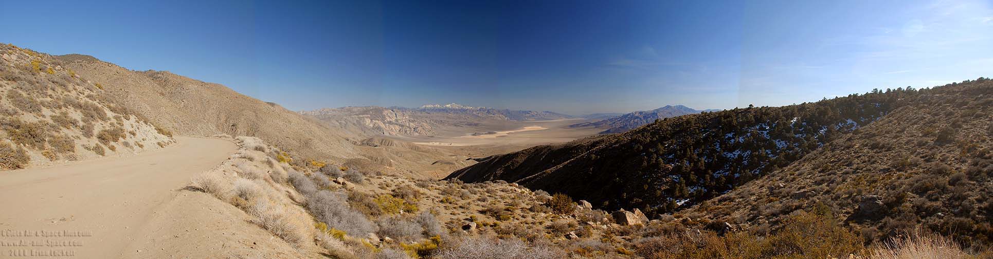
 The view from Rogers Pass in the Panamint Mountains encompasses Death Valley on the left, Warm Springs Canyon in the middle, and Butte Valley on the right.
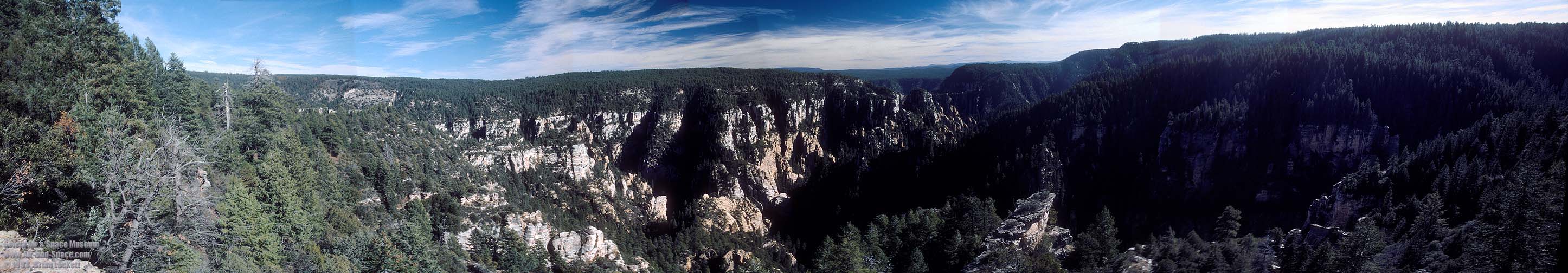 The West fork of Oak Creek Canyon.
 This view of the rim of Barringer Crater, better known as
Meteor Crater, reveals the uplifted rim of the crater, a blanket
of ejecta covering the lower slopes, and large boulders that were
excavated from inside the crater and landed on the outer slopes.
This view of the rim of Barringer Crater, better known as
Meteor Crater, reveals the uplifted rim of the crater, a blanket
of ejecta covering the lower slopes, and large boulders that were
excavated from inside the crater and landed on the outer slopes.

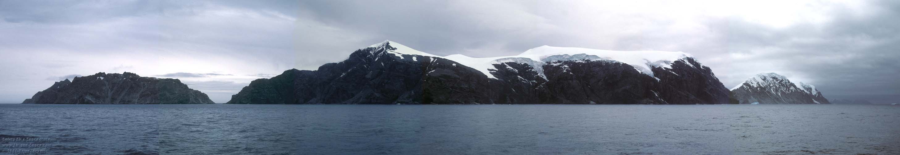
 Andvord Bay.
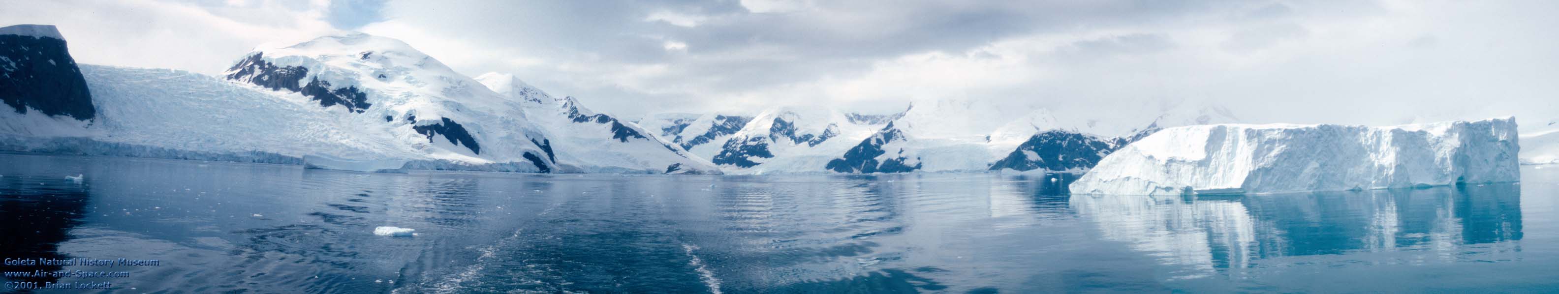
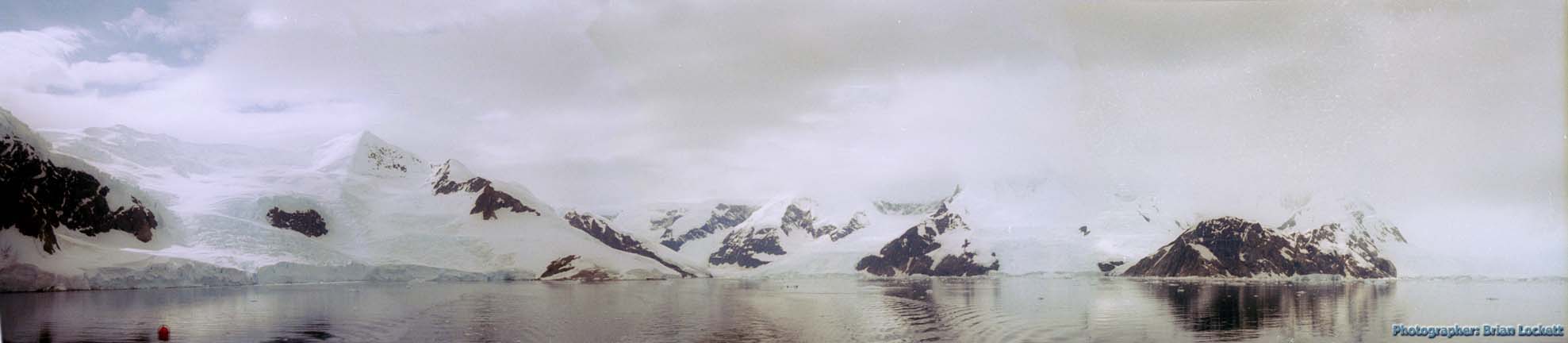 Looking back toward Neko Harbor.
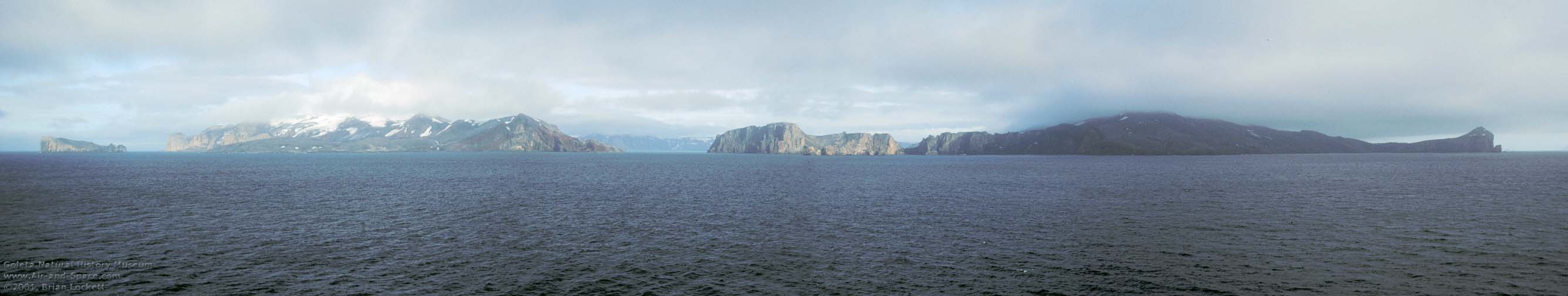 The central crater of Deception Island is a caldera. So much material erupted from the magma chamber under the volcano that it has collapsed into itself. One part of the crater wall has subsided below sea level, creating an entrance into the large harbor in the caldera.
 Ushuaia, Argentina is the southernopmost city on the planet.
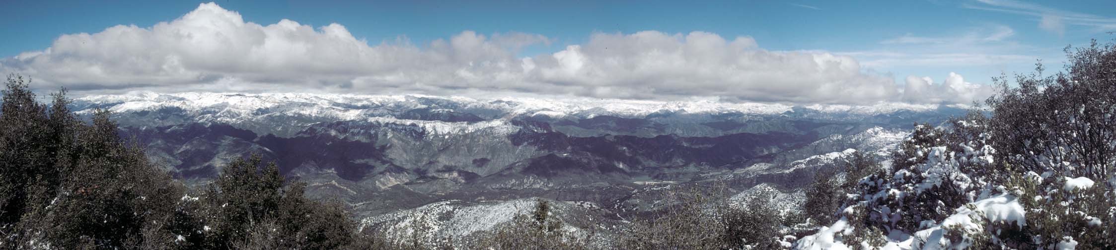 View looking to the north from the crest of the Santa Ynez Mountains across the Santa Ynez Valley into the Santa Barbara County back country on a rare snowy day. Gibralter Dam and Reservior are visible just to the right of center.
 This panoramic view from Hunter Mountain in Death Valley National Park spans over 360 degrees. The valley in the center is Hidden Valley. Racetrack Playa is just to the left of center. My campsite is in the Saline Valley to the left of Racetrack Playa. The highest peaks of the Sierra Nevada are just visible over the Inyo Mountains on the left. Death Valley is to the right.
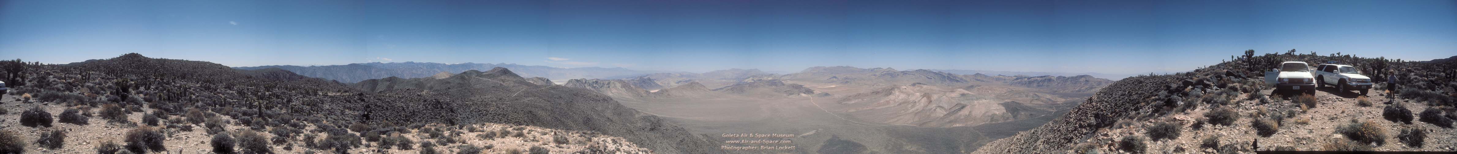
 Panorama of the main base area of Naval Air Weapons Station China Lake from B Mountain. The town of Ridgecrest is at far left. The southern Sierra Nevada is on the horizon at center. The Coso Mountains are to the right. The object at far right is a radar reflector mounted on a pole a few feet away (note its shadow on the ground).
 Here's the view from the Burgess Mine at 6:40 p.m. on the longest day of the year. The wind is blowing pretty hard and the air is cool. The Saline Valley is visible at left. Owens Lake is to the right of center.
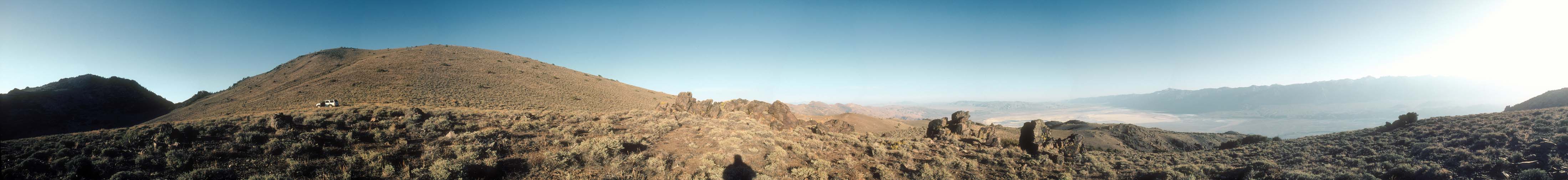
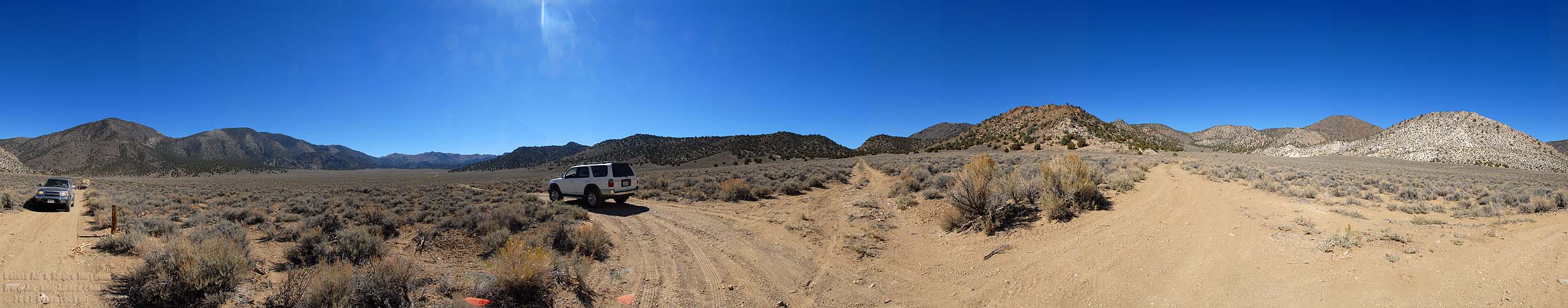
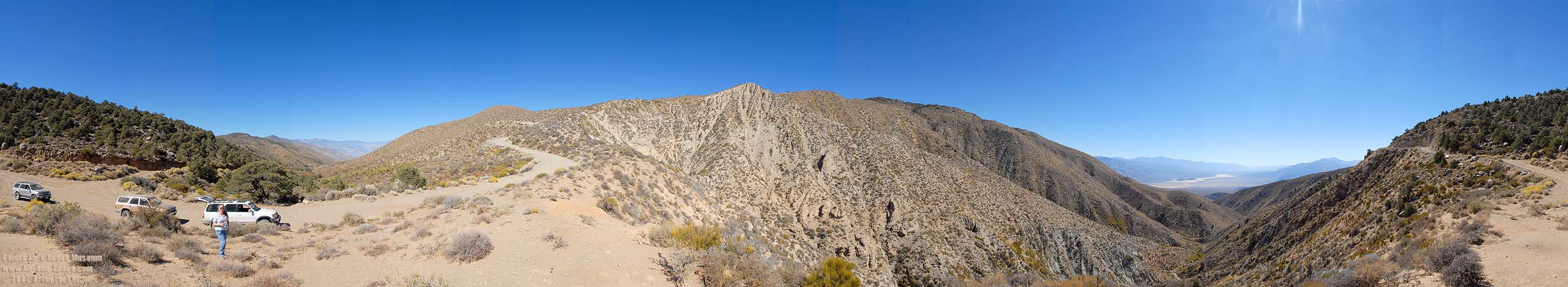
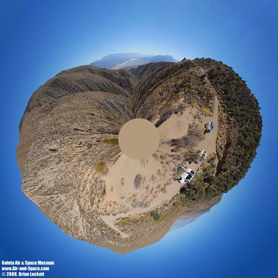
That's New York Butte on the far left. The road ends at the pass. The previous panorama was taken on the ridge visible just to the right of the five boulders. There are ancient Bristlecone Pines on New York Butte and the ridge behind the 4Runner. There is a nice campsite, sheltered under Juniper trees, at the end of the road.
 View from the end of the road at the
base of New York Butte in the Inyo Mountains. The previous
panorama was taken on the ridge below, just to the left of the
snag.
View from the end of the road at the
base of New York Butte in the Inyo Mountains. The previous
panorama was taken on the ridge below, just to the left of the
snag.
 Saline Valley from the
base of New York Butte in the Inyo Mountains.
Saline Valley from the
base of New York Butte in the Inyo Mountains.
 Much of the road is right at the crest of the ridge, with views
of both the Saline Valley on the left and the Owens Valley on the
right. I don't know of any other road that has such expansive
views.
Much of the road is right at the crest of the ridge, with views
of both the Saline Valley on the left and the Owens Valley on the
right. I don't know of any other road that has such expansive
views.
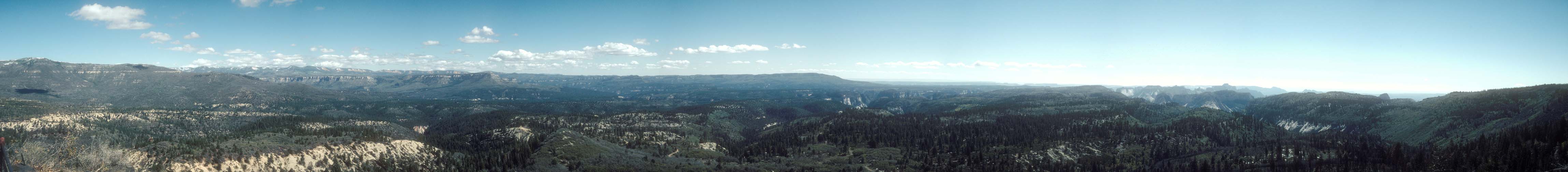
 Lava Point Overlook in Zion National Park.


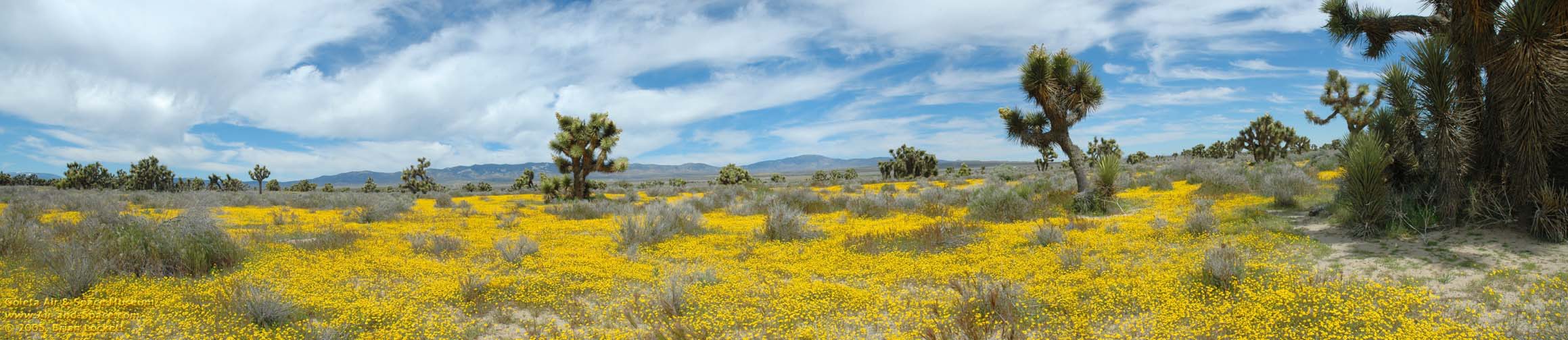
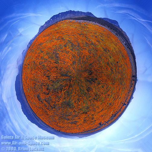 Little planet view of California Poppies in the Antelope Valley.


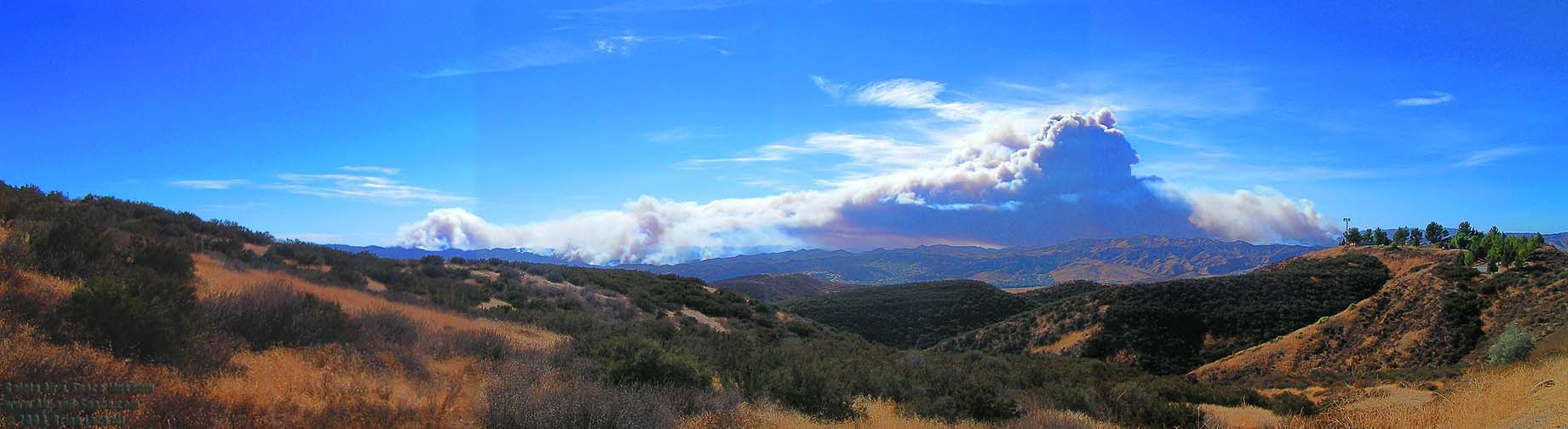 Multiple wildfires burn near Lake Piru and the San Fernando Valley on October 26, 2003.
 Goleta Pier on a cold, clear February morning. The University of California at Santa Barbara (UCSB) can be seen on the left side.

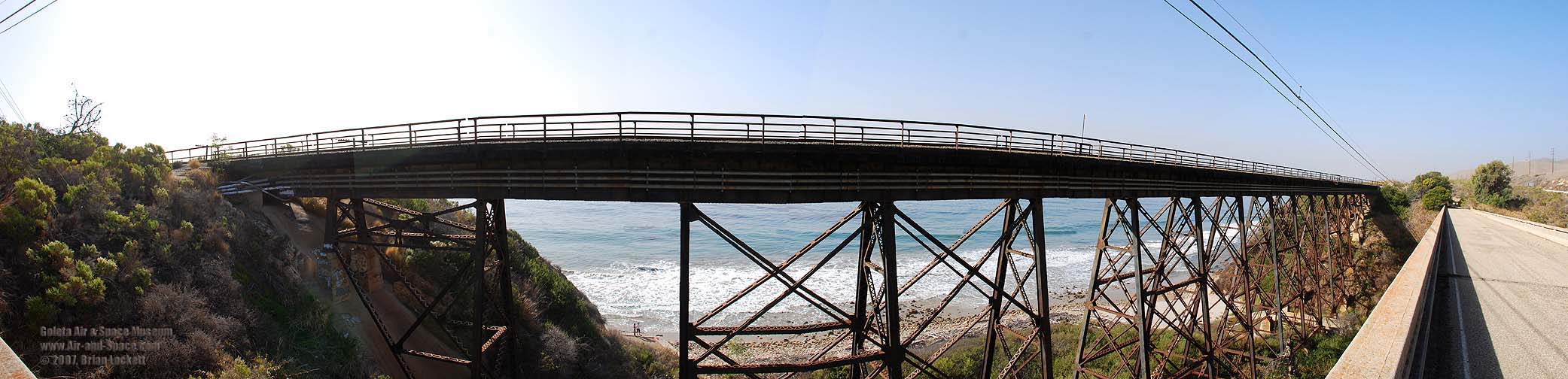
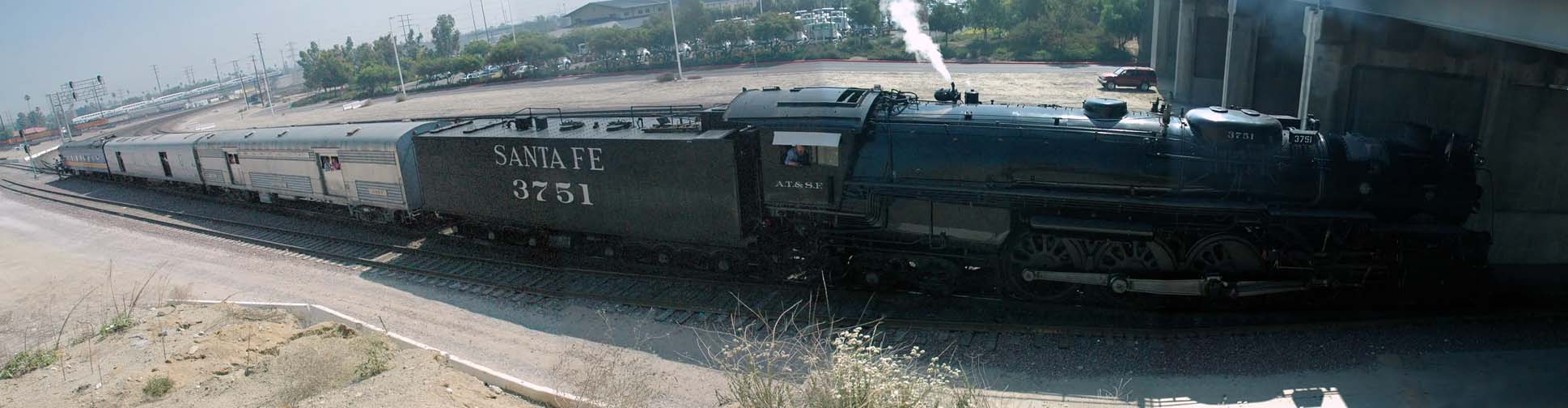 Santa Fe 3751 turns around on the "Y" under Rialto Avenue in San Bernardino.
 We passed through Trona and up to a pass in the Slate Range
to this Panamint Valley overlook.
We passed through Trona and up to a pass in the Slate Range
to this Panamint Valley overlook.
 360-degree panorama of the ghost town of Ballarat.
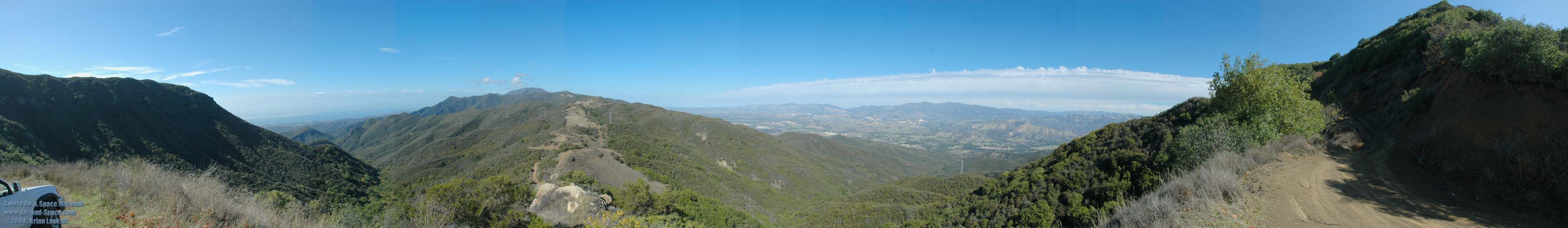
On Thursday, October 21, I shot a series of panoramas along the length of East Camino Cielo on the crest of the Santa Ynez Mountains above Goleta and Santa Barbara. Camino Cielo features many sweeping vistas of the Santa Barbara Channel and the San Rafael Wilderness.
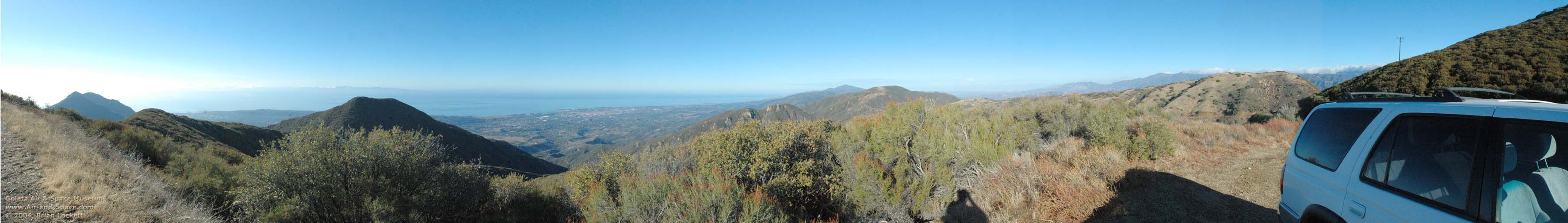
 Our journey begins about four miles from the intersection of Highway 154 and Camino Cielo. The City of Goleta is on the south coast of Santa Barbara County. Santa Ynez Peak is the high point on the ridge in the distance. The gray structure at right is a cistern that collects rain water for fighting fires.
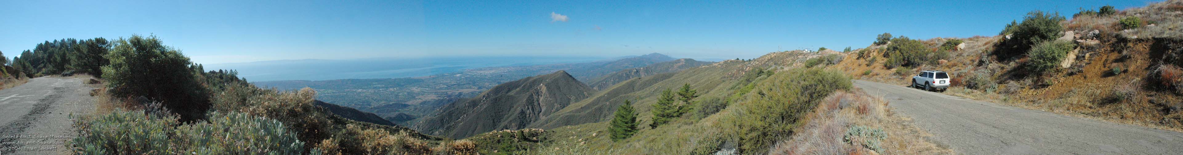
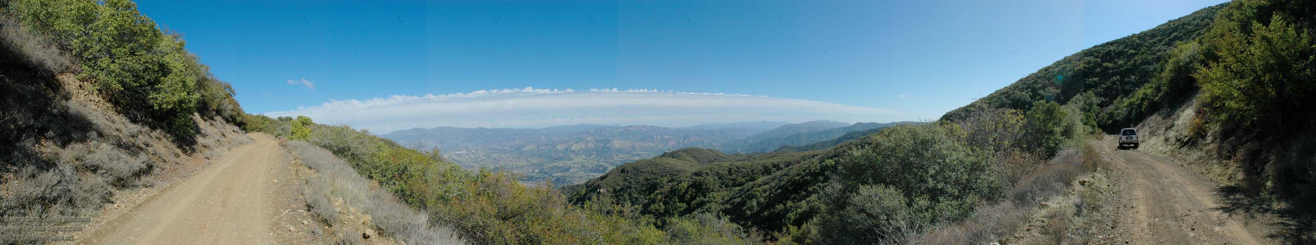
 That is the same cistern that appears in the previous panorama. Santa Ynez Peak is on the left side of this panorama. San Rafael Mountain is the highest peak in the cloud shrouded San Rafael Mountain Range on the horizon. Old Man Mountain, Alexander Peak and Little Pine Mountain are the high points on the ridge in the foreground. Fog shrouds Gibralter Lake and Little Caliente Canyon in the upper reaches of the Santa Ynez Valley. Pine Mountain, in Ventura County, is the high peak on the horizon near the right side of the image.
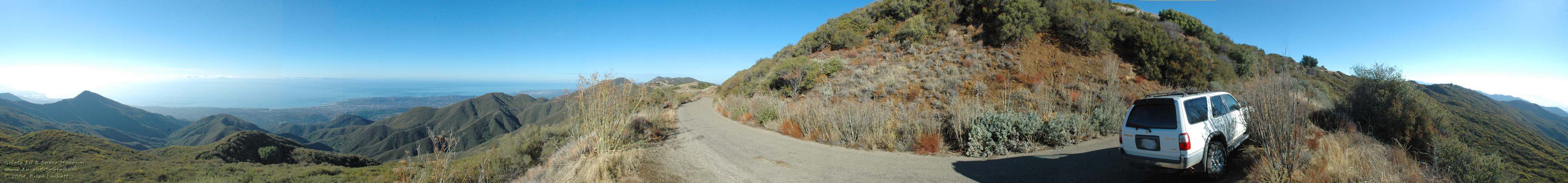
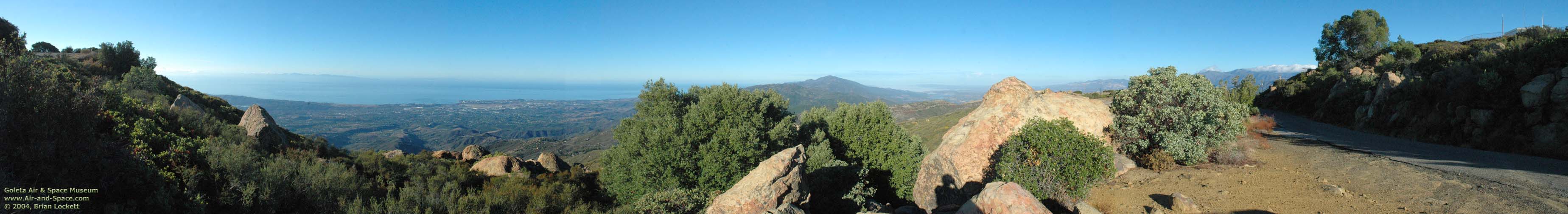 The Goleta Valley and Santa Barbara Channel are at the left. Santa Ynez Peak is at center, and the San Rafael Mountains are at right.
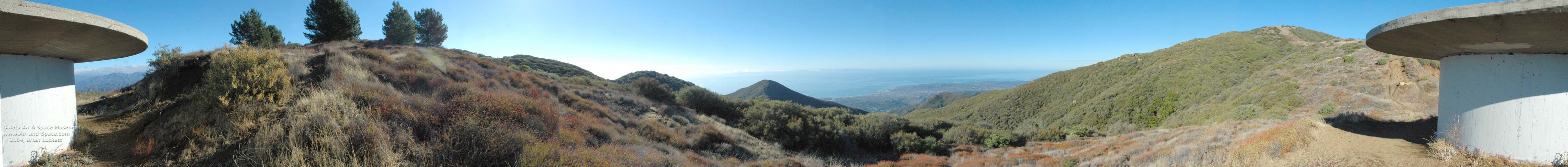
 Cathedral Peak appears at the left. The City of Santa Barbara is visible in the gap to the right of Cathedral Peak. Santa Cruz Island is on the horizon between Santa Barbara and the Goleta Valley. Figueroa Mountain and the San Rafael Mountain Range are at right.
 Above the San Roque district. Pines cover the top of La Cumbre Peak at left. Santa Rosa Island and San Miguel Island are lost in the mist to the west of Santa Cruz Island. Radio repeaters and a VHF Omnidirectional Radio (VOR) navigation facility dot the ridge of the Santa Ynez Mountains.
 This was taken a short distance to the east of La Cumbre Peak. Santa Cruz Island is at far left. The Goleta Valey is at center and Santa Ynez Peak is on the horizon to the right of center.
 This is a full 360-degree panorama. Loon Point is nearly lost in the glare at far left. Montecito Peak stands out against the sunlight reflected off the Santa Barbara Channel. The lagoon at the Andree Clark Bird Refuge can be seen to the left of the City of Santa Barbara. The Goleta Valley is visible through the gap near center. La Cumbre Peak on the far side of Angostura Pass is the high point on the horizon near center.
 This is a full 360-degree panorama taken above Montecito, half-way from the intersection with Gibralter Road and Cold Springs Saddle. The lagoon at the Andree Clark Bird Refuge is right behind the dead Century Plant at left. A lonely cumulus cloud hovers over Santa Barbara. The Goleta Valley is just visible in the gap to the left of the big Juniper Tree. Gibralter Lake peeks through a gap in the chapparal just to the right of the ridge. Little Caliente Canyon and Hildreth Peak are at middle right. Juncal and the Murrietta Divide are at far right.
 This is a full 360-degree panorama taken at Cold Spring Saddle, the trail head of the Cold Springs Trail. It is a 2,600-foot ascent from Mountain Drive. The San Rafael Mountains peek through the opening under the lid of the cistern at left. The Andree Clark Bird Refuge is just visible to the right of Montecito Peak. Montecito and the City of Santa Barbara are near center.
 This is a full 360-degree panorama taken between Cold Spring Saddle and Romero Saddle. The Santa Barbara Channel can be seen on the south side of Camino Cielo. Looking toward the north, Forbush Flats is at the base of the Santa Ynez Mountains in the foreground. Hildreth Peak is sihouetted against the clouds to the right of the fog shrouded Little Caliente Canyon. Cloud topped Pine Mountain, in Ventura County, is the high peak on the horizon near the right side of the image.
 This is a full 360-degree panorama, taken near Romero Saddle at the east end of Camino Cielo. Santa Cruz Island is just visible over Camino Cielo at left. Agua Caliente Canyon leads off into the distance at the right. Juncal and the Murrietta Divide are at far right.
I shot several panoramic photos along West Camino Cielo on November 6, 2004.
 Goleta Overlook
 Santa Ynez Mountain Ridgeline
 Santa Ynez Valley Overlook
 Santa Ynez Peak
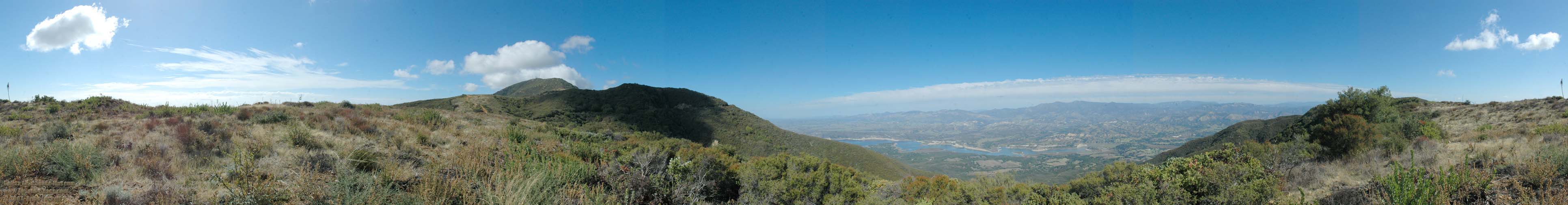
 Lake Cachuma Overlook
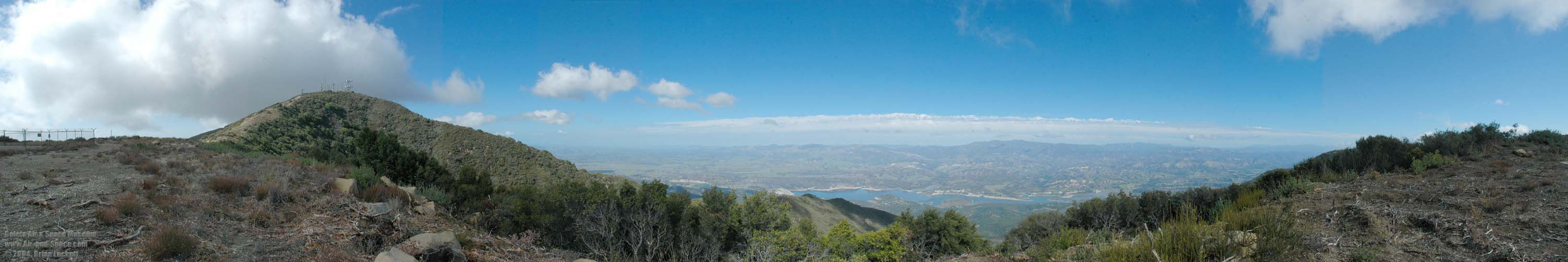
 Santa Ynez Peak Summit
 NASA's Boeing NB-52B Stratofortress Mothership was retired in a ceremony at the Dryden Flight Research Center at Edwards Air Force Base on Friday December 17, 2004. The NB-52B has been a fixture at Edwards AFB for forty-nine years. It first launched a North American X-15 rocket plane on January 23, 1960. Its final mission was the launch of the third X-43A
Hyper-X, which demonstrated that an air-breathing engine can
propel a vehicle at Mach-10 on the afternoon of November 16, 2004.
NASA's Boeing NB-52B Stratofortress Mothership was retired in a ceremony at the Dryden Flight Research Center at Edwards Air Force Base on Friday December 17, 2004. The NB-52B has been a fixture at Edwards AFB for forty-nine years. It first launched a North American X-15 rocket plane on January 23, 1960. Its final mission was the launch of the third X-43A
Hyper-X, which demonstrated that an air-breathing engine can
propel a vehicle at Mach-10 on the afternoon of November 16, 2004.
 The laandslide at La Conchita claimed several lives.
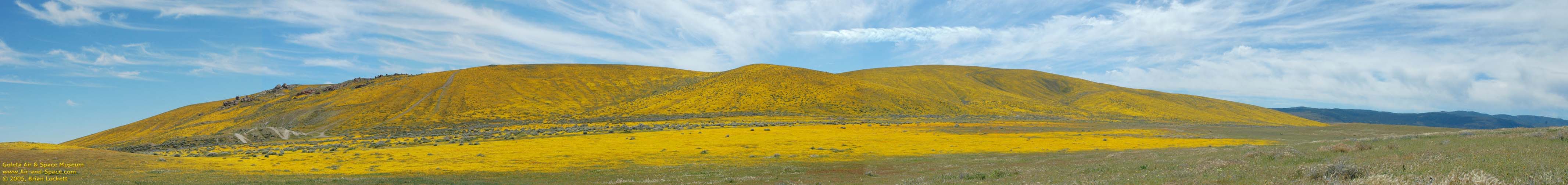
 California Poppies

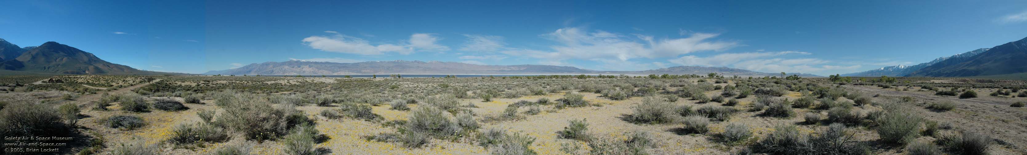
 Owens Lake actually has water in it. The Inyo Mountains are on the other side of Owens Lake at left. The Coso Range is on the right.
 The Sierra Nevada appears at both ends of the panorama.
 The Inyo Mountains at sunset from the Owenyo Road, near Lone Pine. The Sierra Nevada appears on both sides of this panoramic photo.
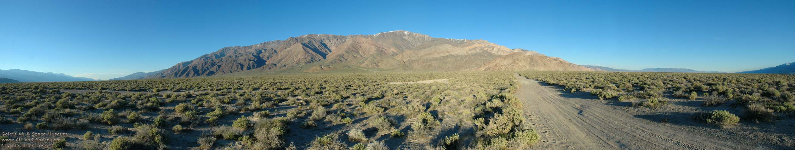
 The first light of day bathes the snowy Sierra Nevada. Horseshoe Meadow Road is just a few minutes up the Whitney Portal Road from Lone Pine.
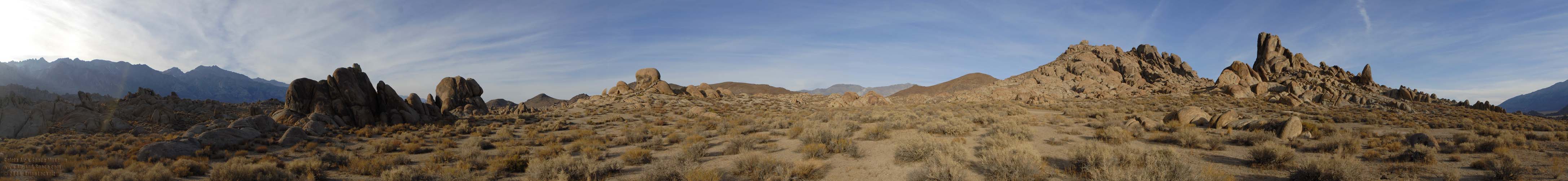
 Movie Road leads through the Alabama Hills, where a great many Hollywood productions were filmed.
 Switchbacks of the Whitney Portal Road can be seen in the foothills of the Sierra Nevada.
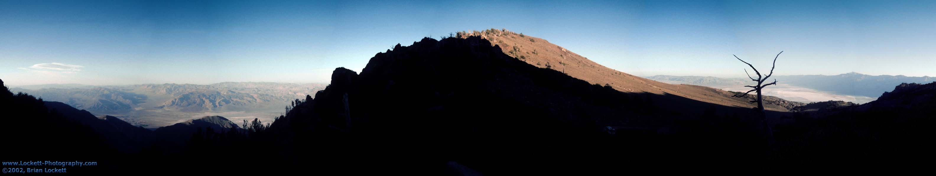
 Rainbow Gorge is at left. Highway 190 winds down to the floor of the Panamint Valley though brightly colored volcanic rock. Telescope Peak and the higher peaks in the Panamint Mountains are still shrouded in snow.
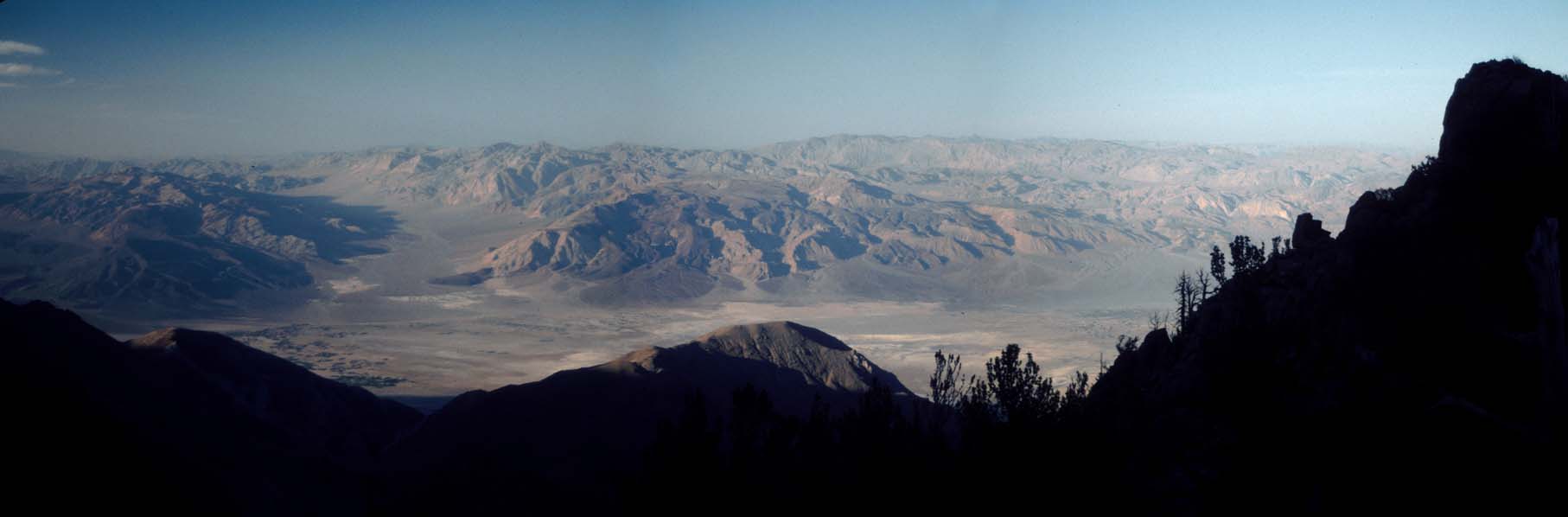
 Augereberry Point is at the end of the road at the left of this panorama. Badwater, the lowest point in North America is just to the right of center.
 Rainbow Gorge is at left. Highway 190 winds down to the floor of the Panamint Valley though brightly colored volcanic rock. Telescope Peak and the higher peaks in the Panamint Mountains are still shrouded in snow.
![]() REWORKED: Extreme wide-angle view of the Eureka-Saline Corridor shows the Inyo Mountains at left, the Saline Range in the middle and the Last Chance Range at the right. The most prominent peaks in the Inyos are New York Butte, Mount Inyo, and Keynot Peak, all higher than 11,000 feet.
REWORKED: Extreme wide-angle view of the Eureka-Saline Corridor shows the Inyo Mountains at left, the Saline Range in the middle and the Last Chance Range at the right. The most prominent peaks in the Inyos are New York Butte, Mount Inyo, and Keynot Peak, all higher than 11,000 feet.
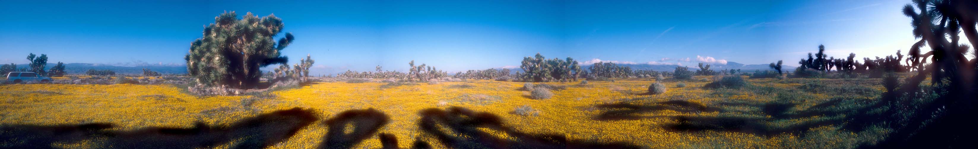
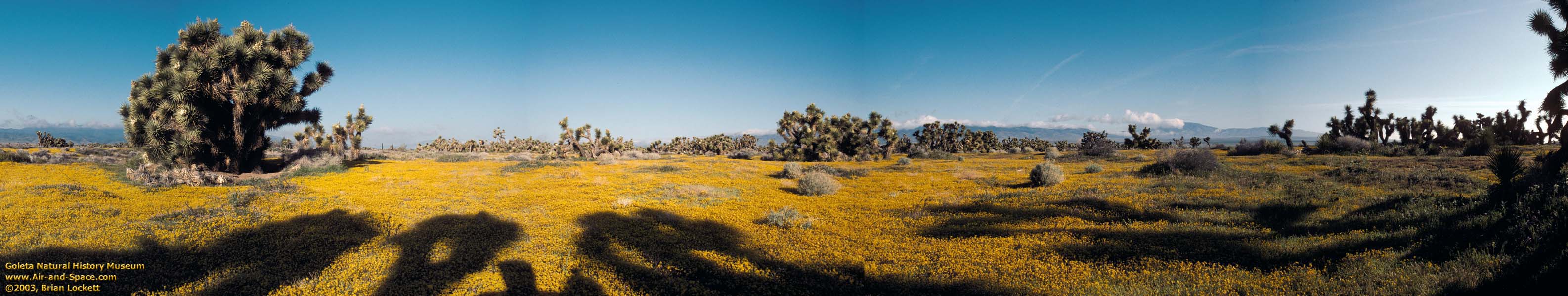
 Panoramic view of Palm Spring.
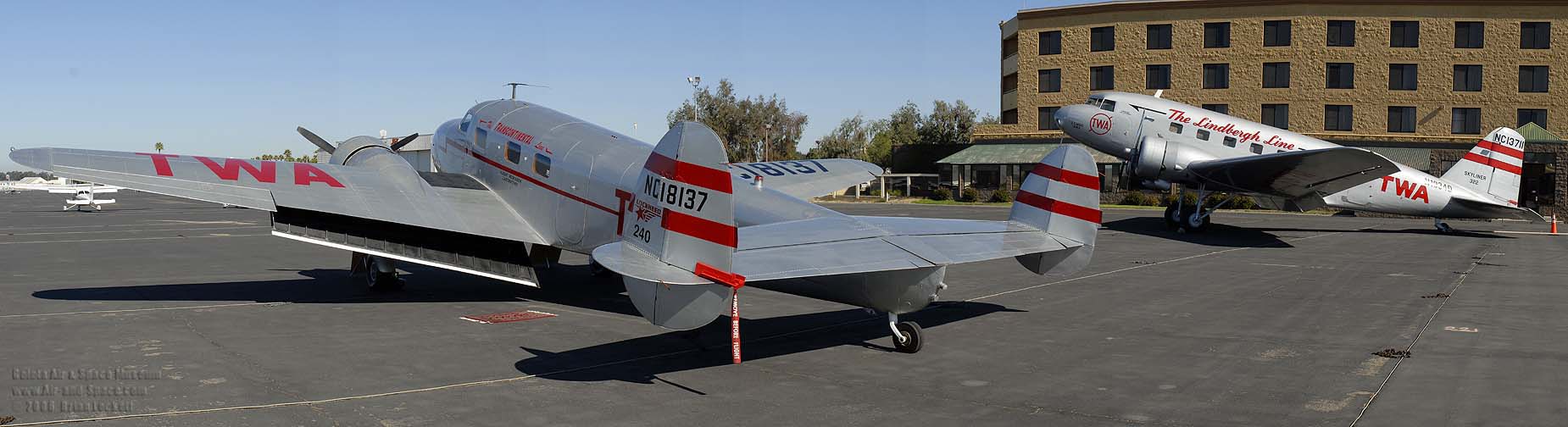 Lockheed Model 12A Electra, NC18137 The Spirit of New York and Douglas DC-2-118B NC1934D at the Santa Maria Airport on Saturday, October 21, 2006.
 Over 2006 Veteran's Day weekend I toured Owens Valley, the Inyo Mountains, Panamint Valley, and Trona Pinnacles.
Friday afternoon I drove up into the Alabama Hills to shoot panoramas along Movie Road before the Sun disappeared behind the Sierra Nevada.
Over 2006 Veteran's Day weekend I toured Owens Valley, the Inyo Mountains, Panamint Valley, and Trona Pinnacles.
Friday afternoon I drove up into the Alabama Hills to shoot panoramas along Movie Road before the Sun disappeared behind the Sierra Nevada.
Take the panoramic tour of the High Desert on Google Earth. When Google Earth opens, expand 20061110-12_High_Desert_Tour.kmz, click on the folder labeled Fall 2006 High Desert Tour, and hit F10 to view the panoramic tour. Click on the cameras to see the pictures. Click on the pictures to link to higher resolution versions.
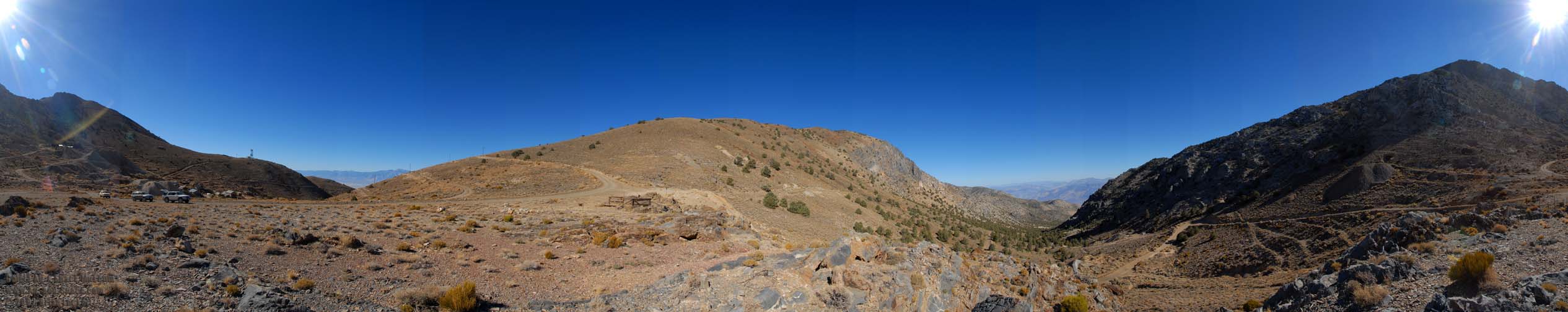
On Saturday morning, I made the long climb to Barber Point (aka Mazourka Peak) at an elevation of 9,400 feet. It's an easy drive that does not require 4-wheel drive.
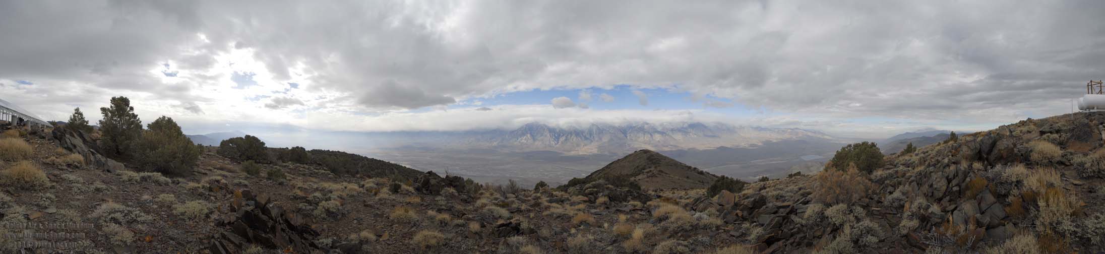 It was overcast and cold on the mountain. Snow was falling on the Sierra Nevada at a lower elevation than I was standing at. There is an antenna farm up there, so I had five bars of cell phone signal strength.

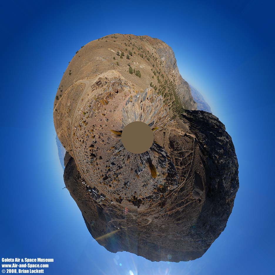
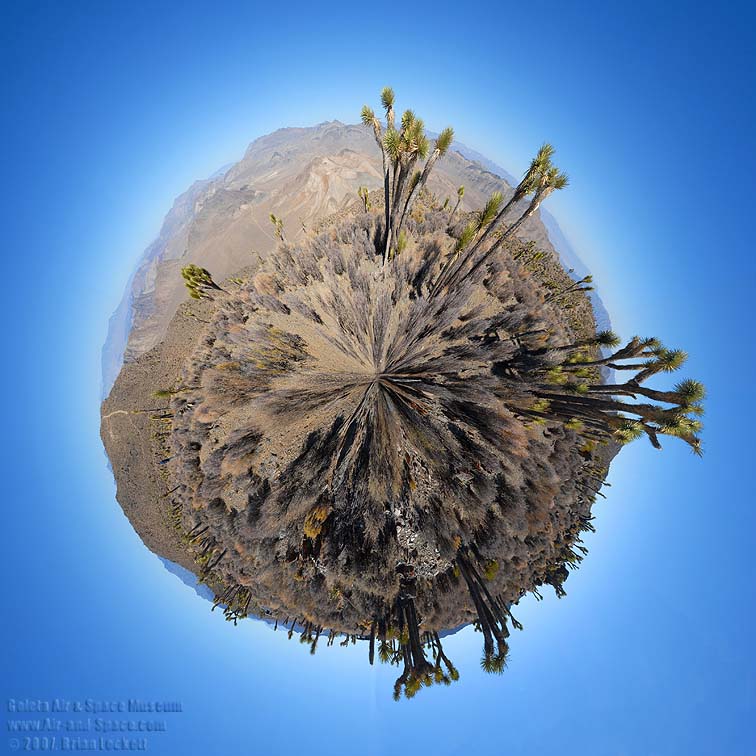
 Little planet view of Papoose Flat

 Little planet view of Harkless Flat
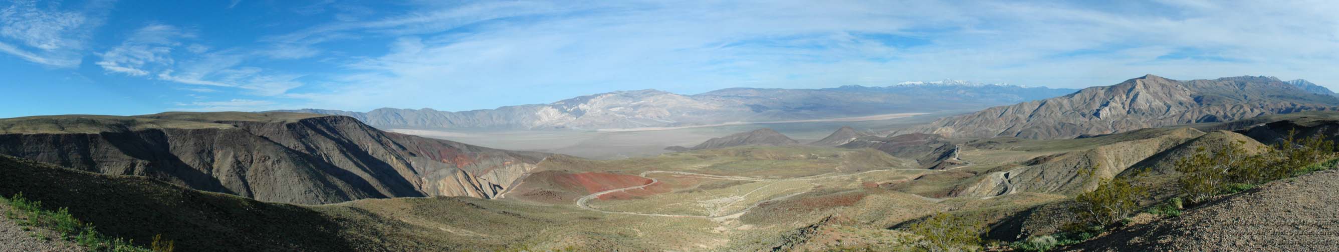
On Sunday I drove home through the Panamint Valley.
 Father Crowley Overlook
 Little planet view of Father Crowley Overlook
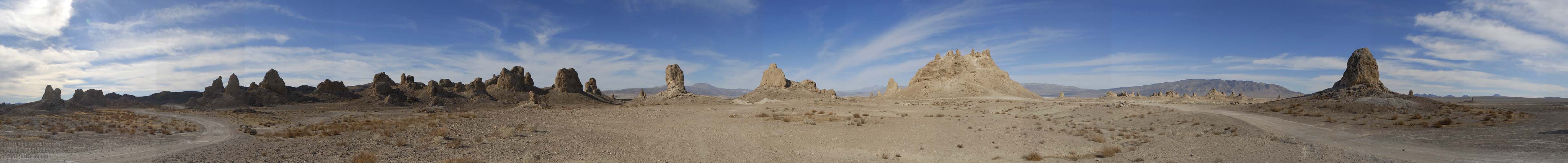
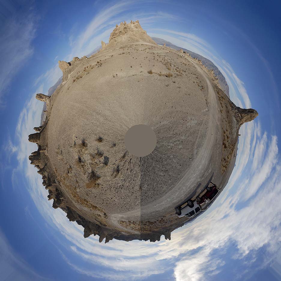 Little planet view of Trona Pinnacles.
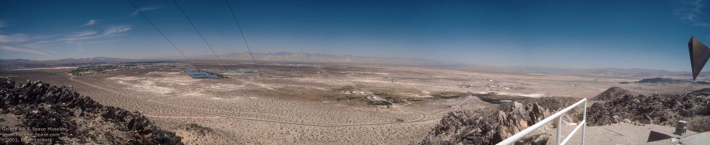
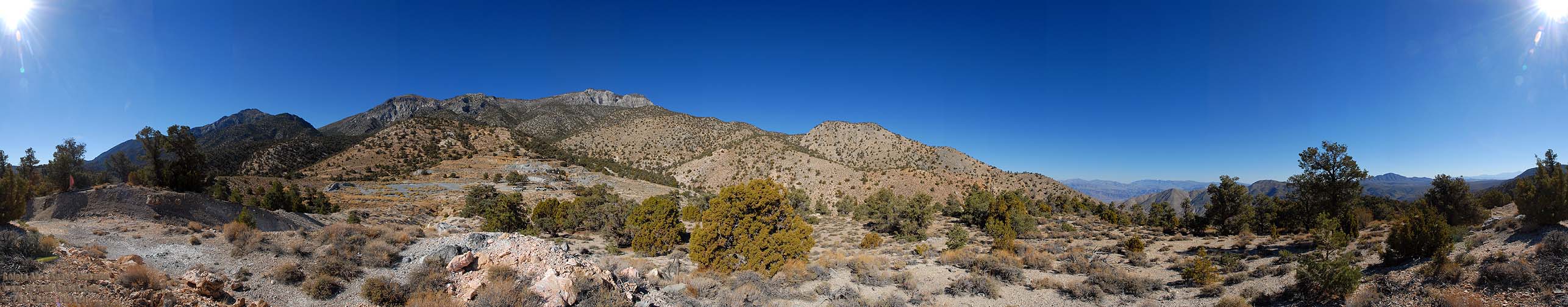
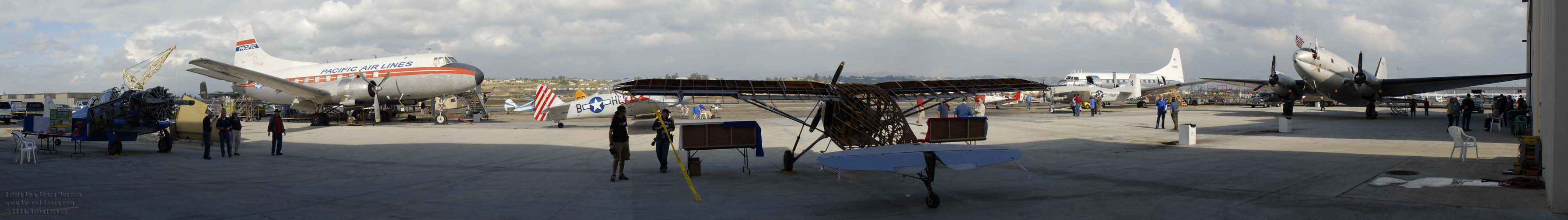 Extreme wide-angle view of the Commemorative Air Force ramp.
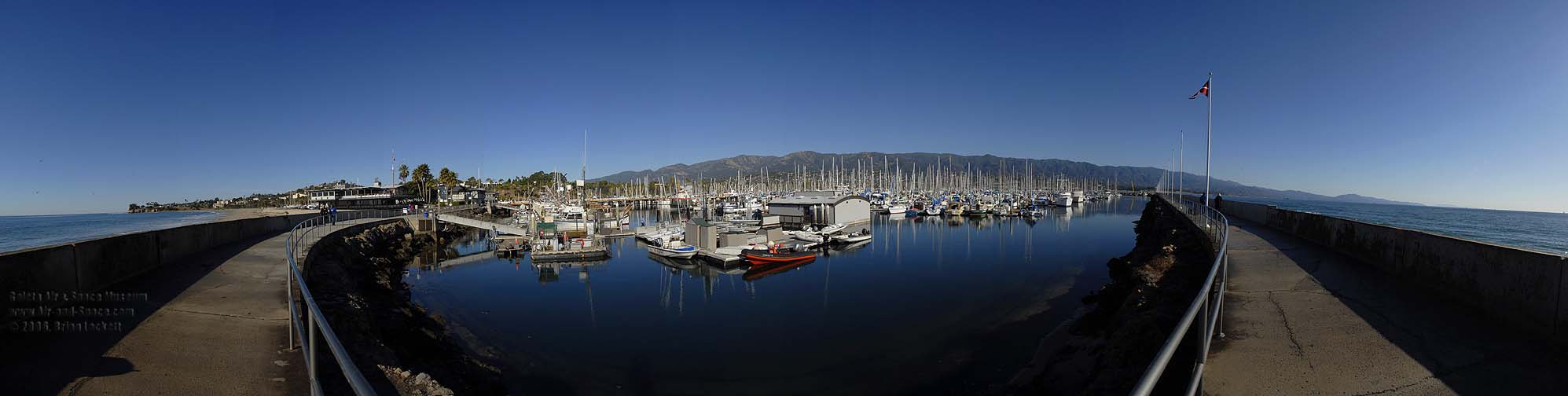
I shot several panoramic photos of Santa Barbara Harbor and overviews of the city from the top of the Courthouse tower on Sunday, January 14.
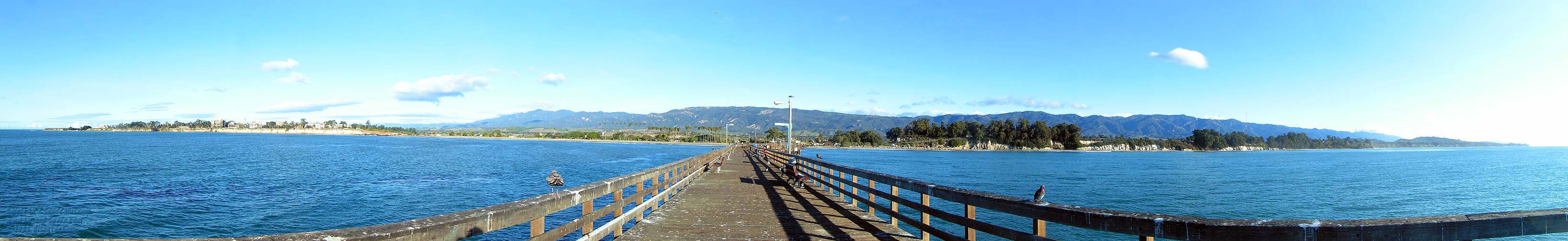
 Leadbettor Beach and the Santa Barbara Harbor.
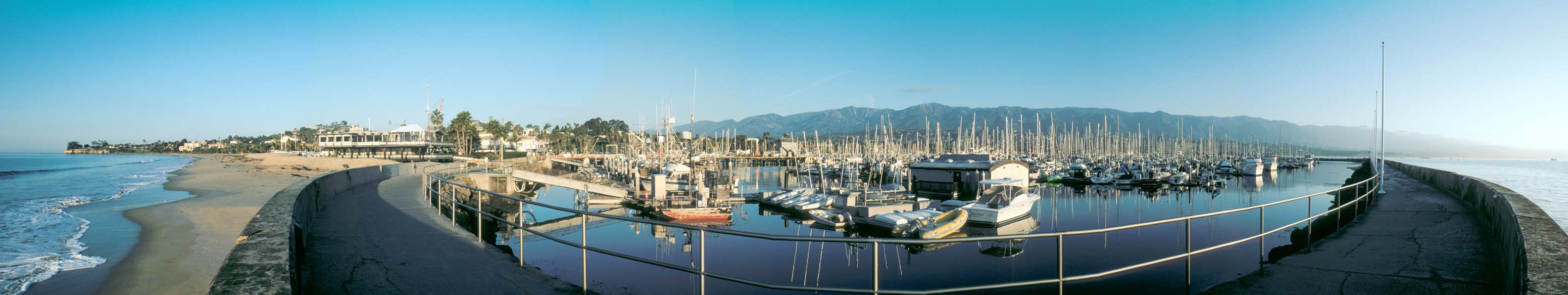
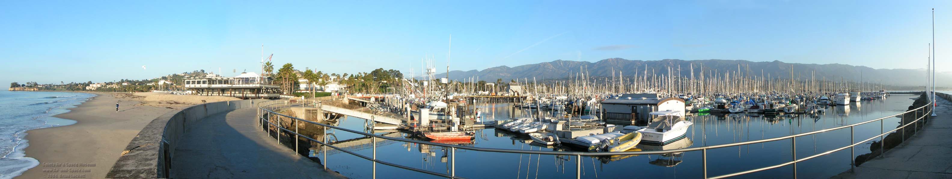
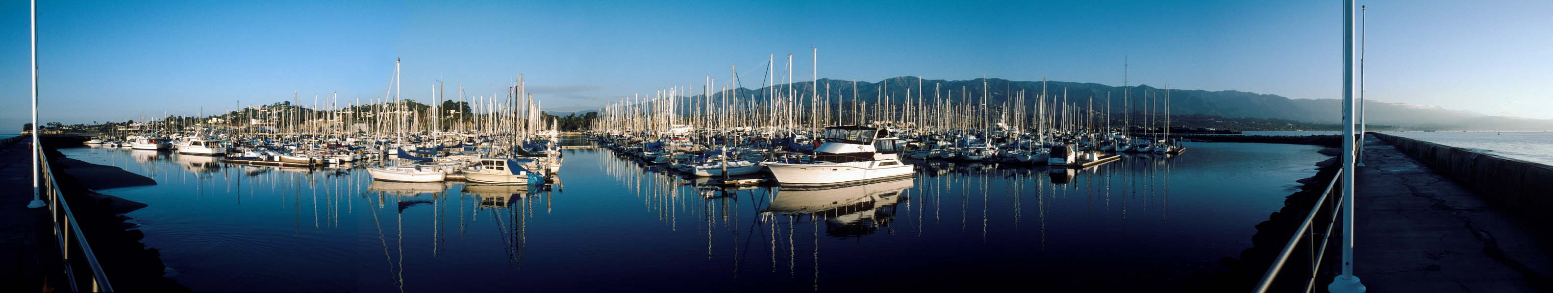
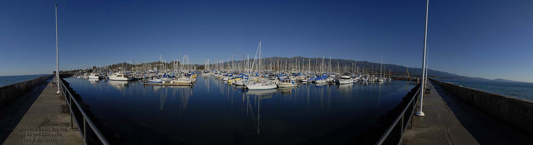 View of the marina from the breakwater.
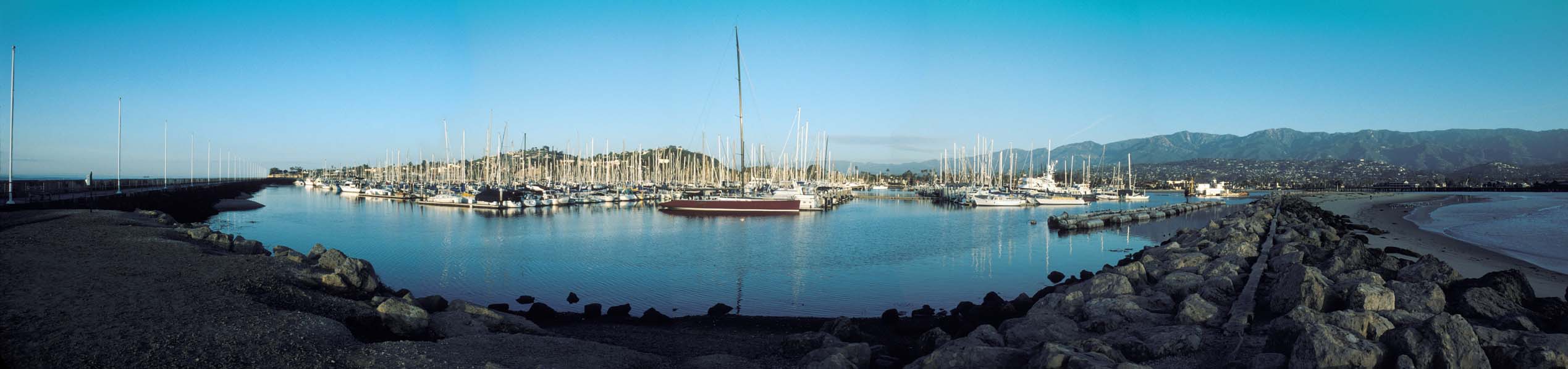
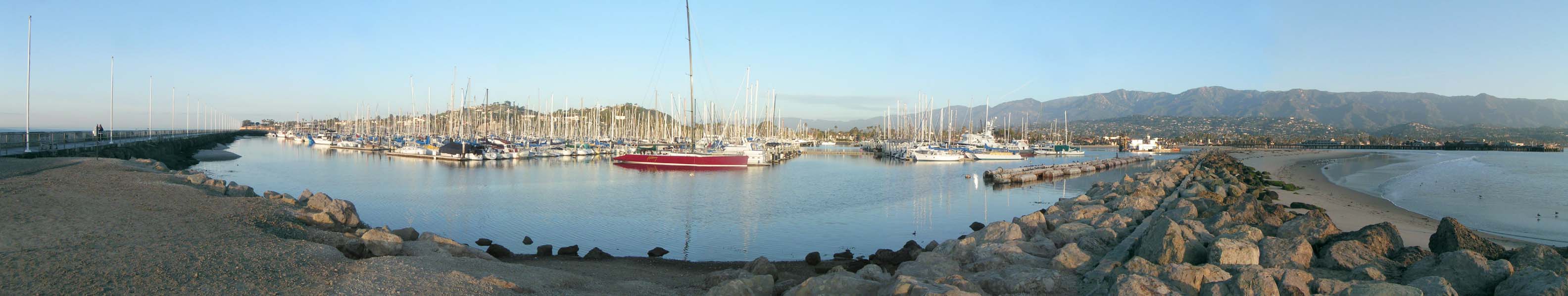
 The Santa Barbara waterfront and Stearns Wharf seen from the end of the sandspit at the mouth of the harbor.
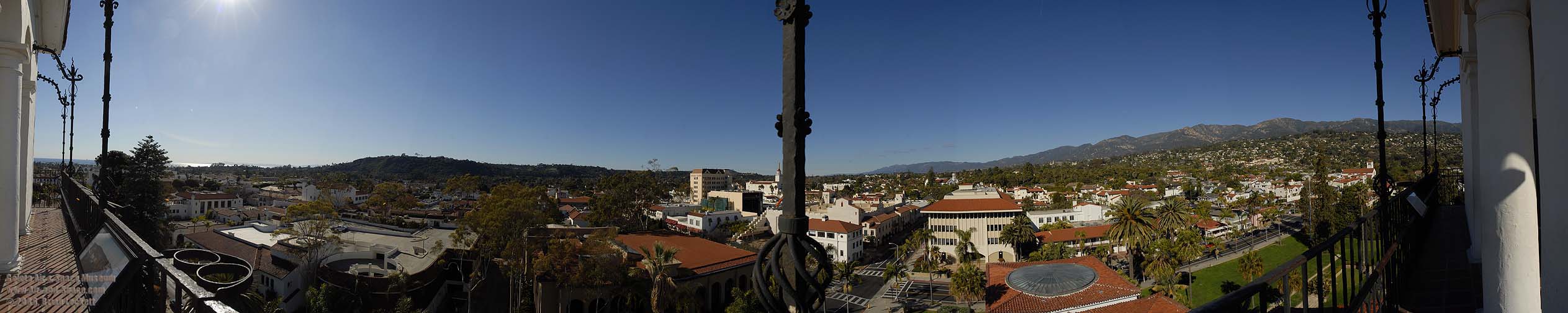
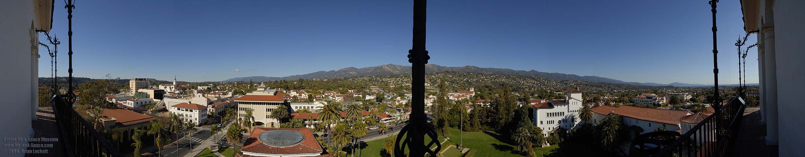 View from the northwest corner of the courthouse tower.
 View from the southwest corner of the courthouse tower.
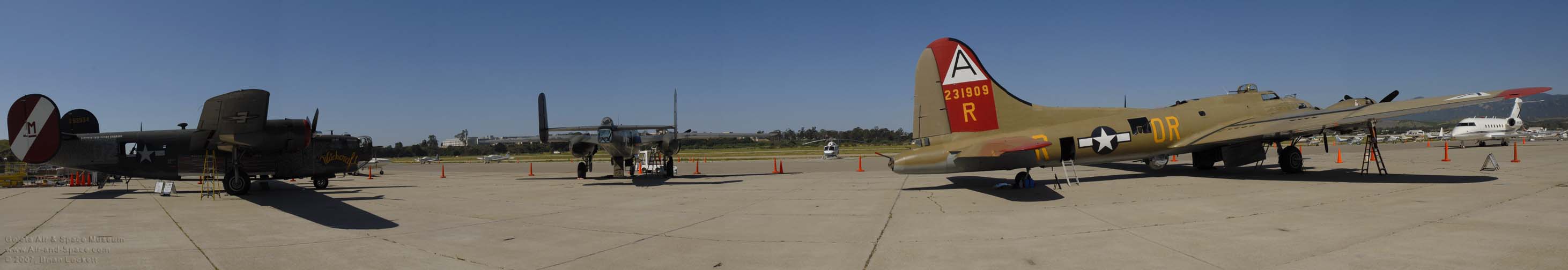 The Collings Foundation Bombers, Boeing B-17G Flying Fortress, N93012 Nine-O-Nine, North American B-25J Mitchell, NL3476G Tondelayo, and Consolidated B-24J Liberator, N224J Witchcraft arrived at the Santa Barbara Airport on Monday, May 7, 2007 and departed for San Luis Obispo on Wednesday, May 9. The bombers were displayed on the flightline at Mercury Aviation.
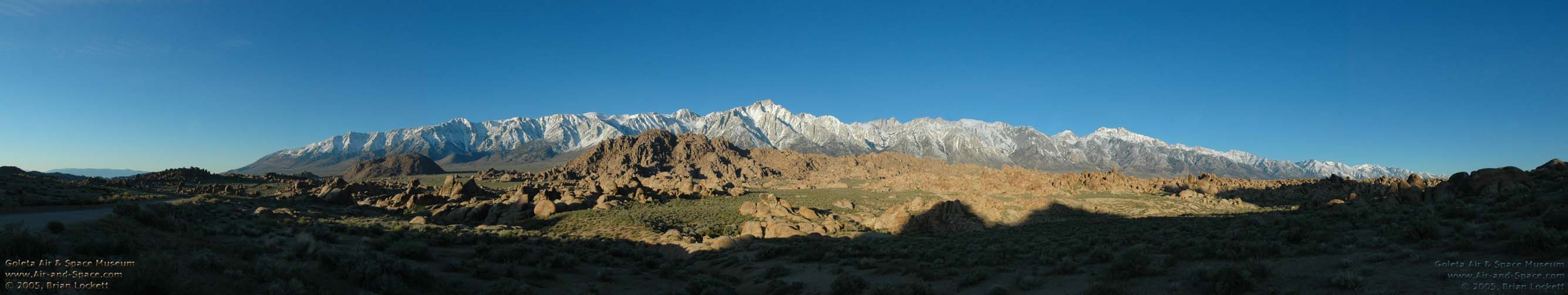
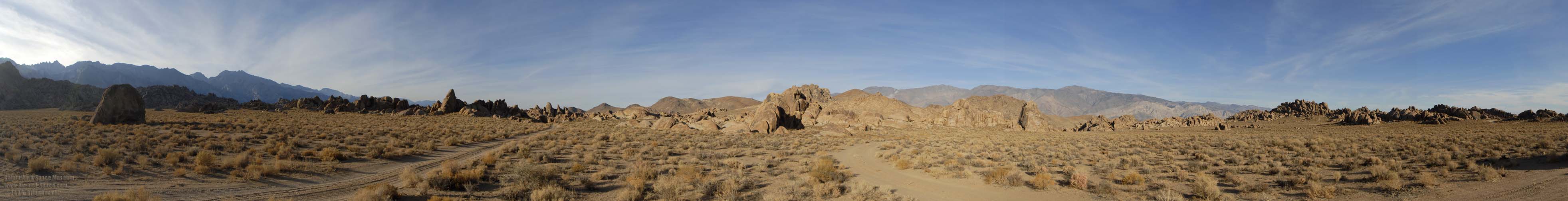
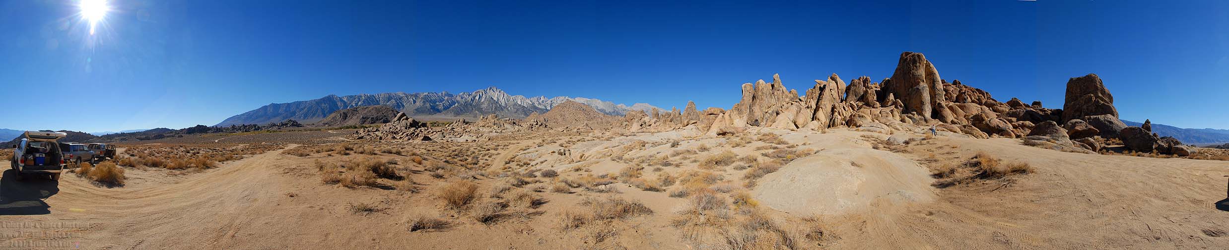 360-degree panorama of the Alabama Hills and the Sierra Nevada at an elevation of 4,500 feet. The Inyo Mountains appear at both ends of the panorama.
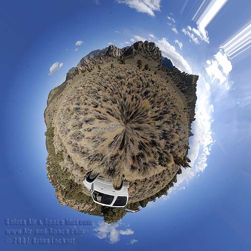
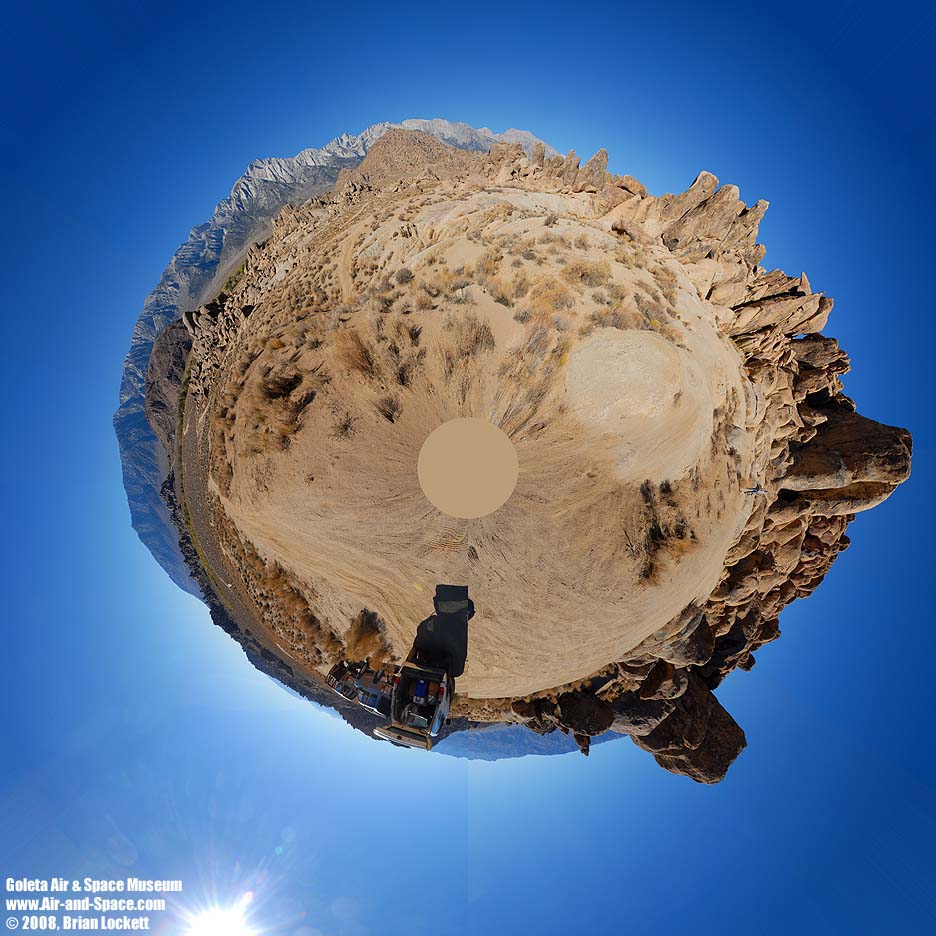 Little planet view of the Alabama Hills and the Sierra Nevada.
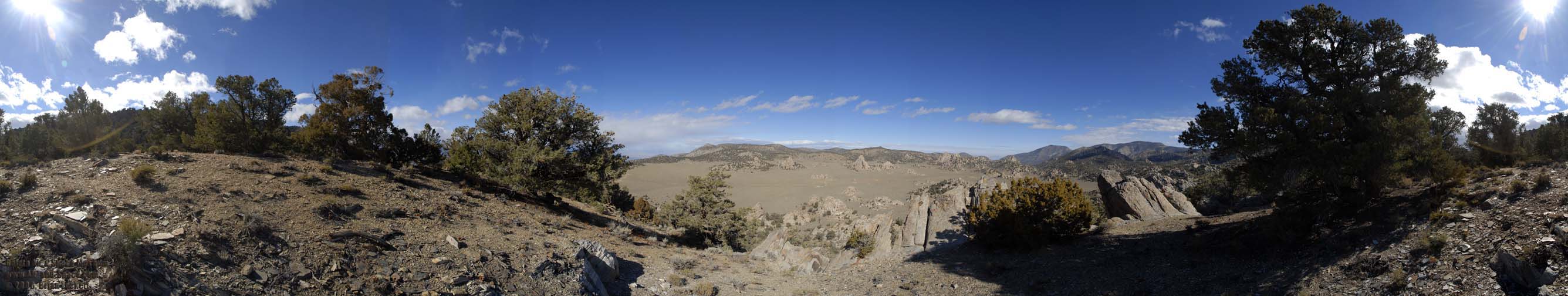
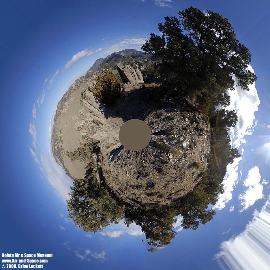
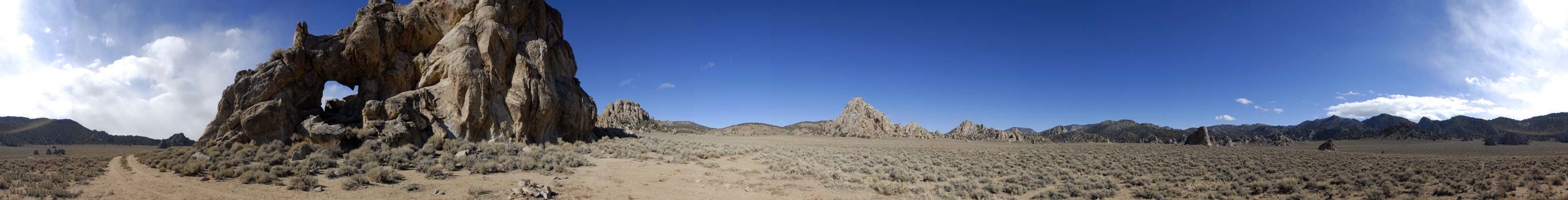
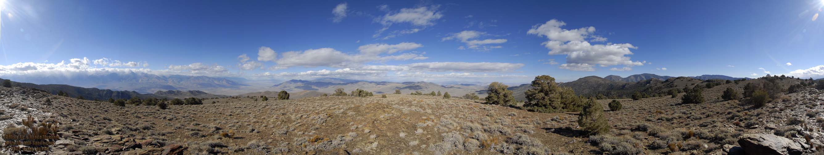
 360-degree panorama of the Narrows in the Inyo Mountains at an elevation of 7,400 feet. Squaw Peak towers over the center of the image.
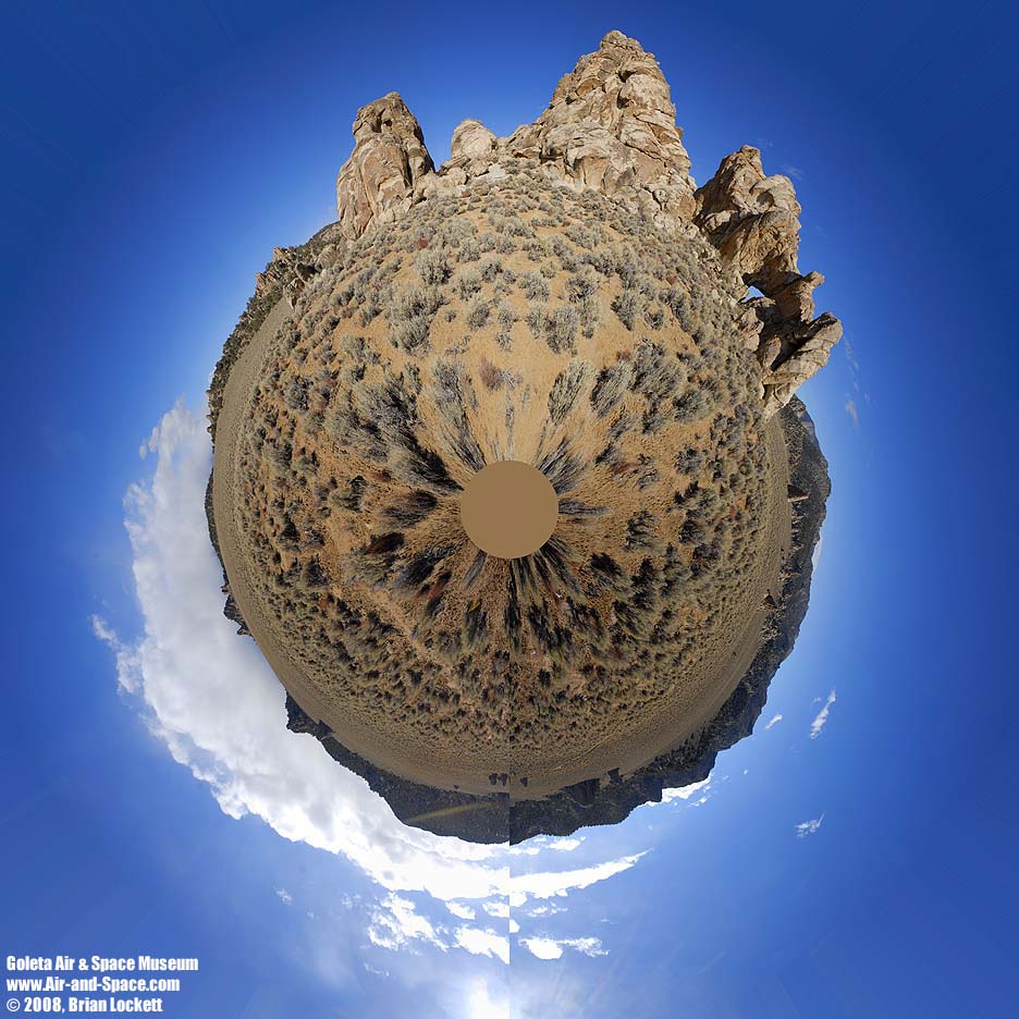
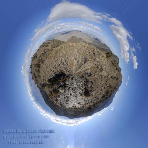
 Little planet view of of the Narrows in the Inyo Mountains.
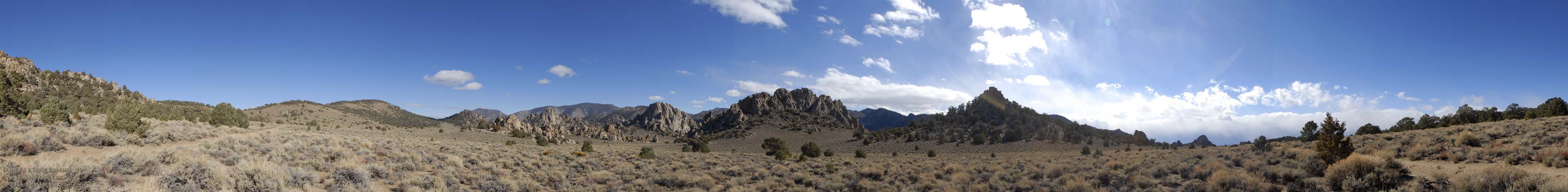
 360-degree panorama of Squaw Flat at an elevation of 7,700 feet. Sqaw Peak and Waucoba Mountain are the highest mountains in the image on the left. Andrews Mountain is to the right of center.
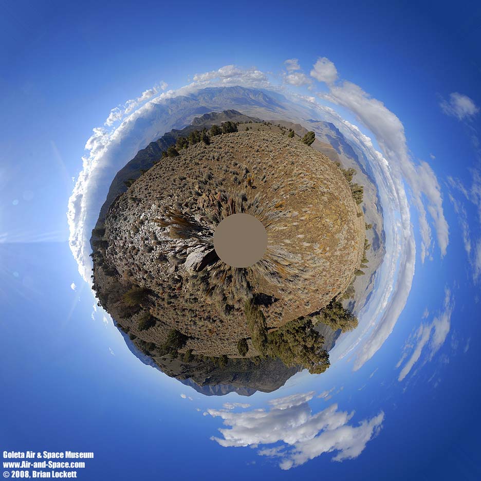
 Little planet view of Squaw Flat.
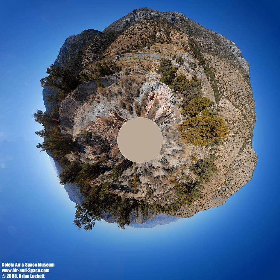
 360-degree panorama of Cerro Gordo Pass at an elevation of 8,200 feet. The ghost town of Cerro Gordo is at left. The Sierra Nevada can be seen on the far side of Owens Valley. The mountain at center is 9,200 feet tall. The Eureka Saline Corridor leads up to Steele Pass on the far side of the Saline Valley. Cerro Gordo Peak at right is 9,100 feet tall.
 Little planet view of Cerro Gordo Pass.
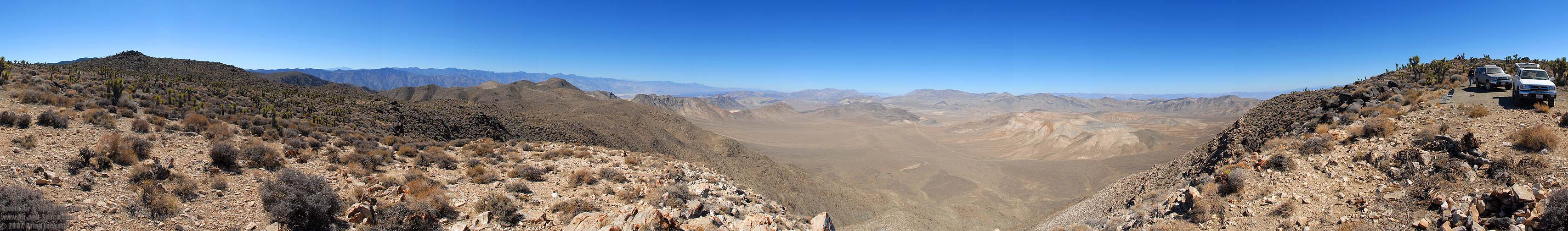
 360-degree panorama taken from the Holiday Mine at an elevation of 6,700 feet. Cerro Gordo is on the left. Tin Mountain and Dry Mountain are visible on the far side of the Saline Valley. The Nelson Range and Lee Flat are at right. The Panamint Mountains are faintly visible on the horizon.
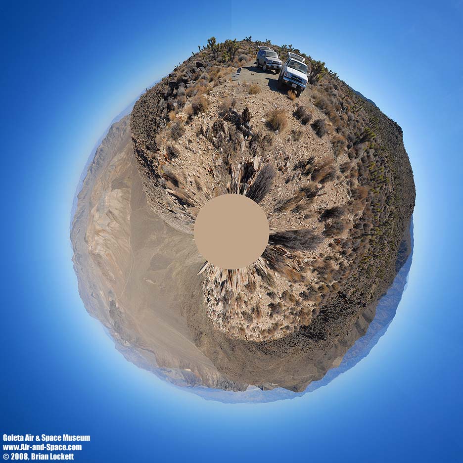
 Little planet view from the Holiday Mine.
 360-degree panorama from the south pass into the Saline Valley at an elevation of 5,900 feet. Grapevine Canyon Leads down into the Saline Valley at left. Hunter Mountain is in the middle. Panamint Valley is at right.
 Little planet view from the south pass into the Saline Valley.
 360-degree panorama from Hunter Mountain at an elevation of 6,500 feet. The peaks of the Inyo Mountains are visible at left. Hidden Valley is in the middle and Death Valley is to the right.
 Little planet view from Hunter Mountain.
 360-degree panorama from Hunter Mountain at an elevation of 6,500 feet. The Nelson Range and the peaks of the Sierra Nevada are visible at left. The Saline Valley and Inyo Mountains are left of center. The White Mountains are faintly visible beyond Racetrack Playa in the middle. Hidden Valley is to the right of center.
 Little planet view from Hunter Mountain.
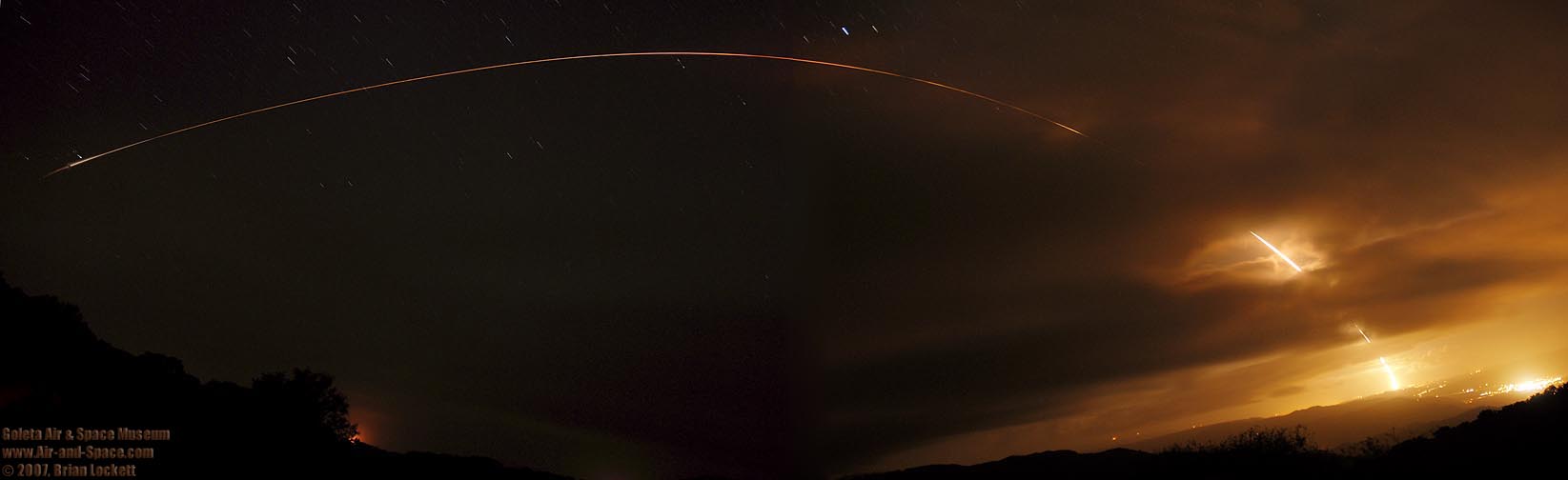 The second Italian COSMO-SkyMed mission was launched on a Delta-II booster at 6:31 PM PST on Saturday, December 8, 2007. In order to place it in the same orbital plane as the first COSMOS-Skymed satellite, the launch window was only one second long. The launch had been scrubbed due to upper level winds two minutes before launch on Wednesday. Lower level winds prevented a launch attempt on Friday. Turbulent weather conditions put the launch on Saturday in jeapardy. The Delta-II ascended through some cloud decks shortly after launch. I used two cameras to capture the launch from ignition through burnout of the first stage. The two cameras shot sequences of thirty-second long exposures that were stacked to produce this composite image.
I spent four days in the Saline Valley in March 2008. The weather was as good as it gets. Lows were in the 50s, the highs were about 90. The wind was nearly nonexistent until the last afternoon.
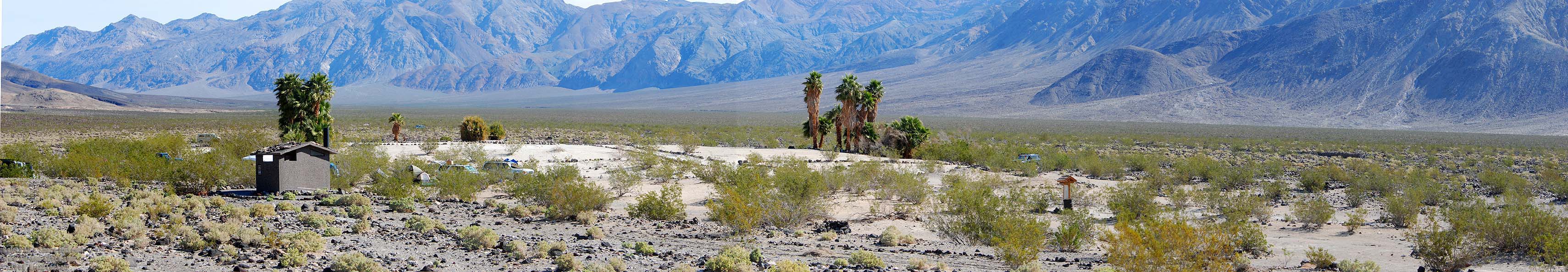
 Panoramic view of Panamint Valley
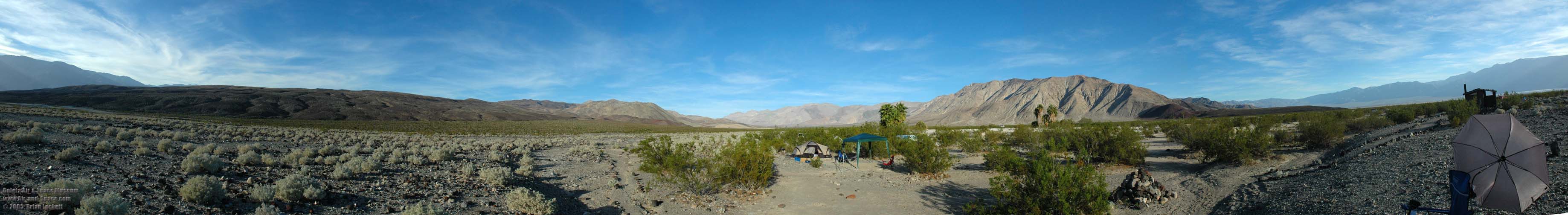
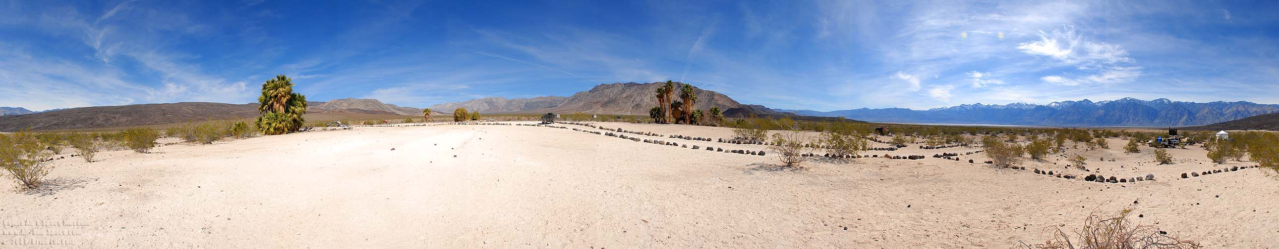 Panoramic view of the camp.
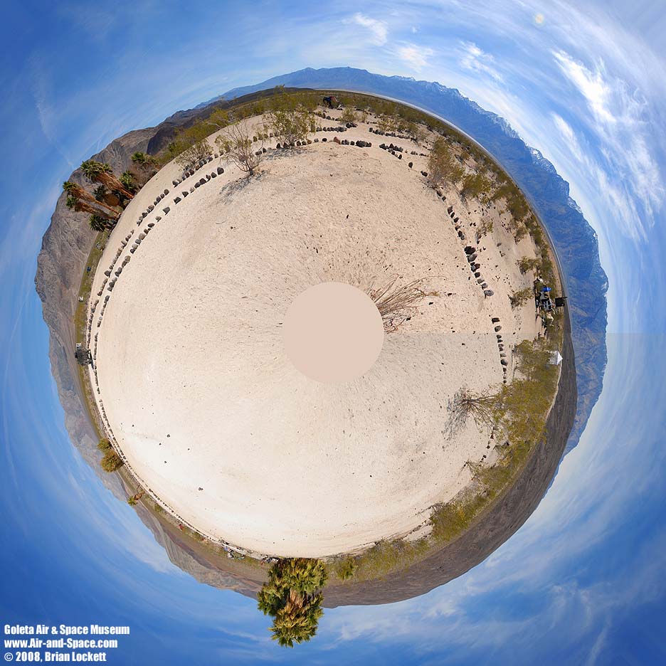 Saline Valley little planet.
 Panoramic view of the camp.
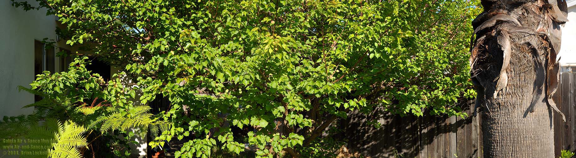 Apricot Tree
![]() California Poppiies in the Antelope Valley on April 26, 2008.
California Poppiies in the Antelope Valley on April 26, 2008.